You are here: Home > Network List > US - United States National Seismic Network Stations List
> Station DGMT Dagmar, Montana, USA > Earthquake Result Viewer
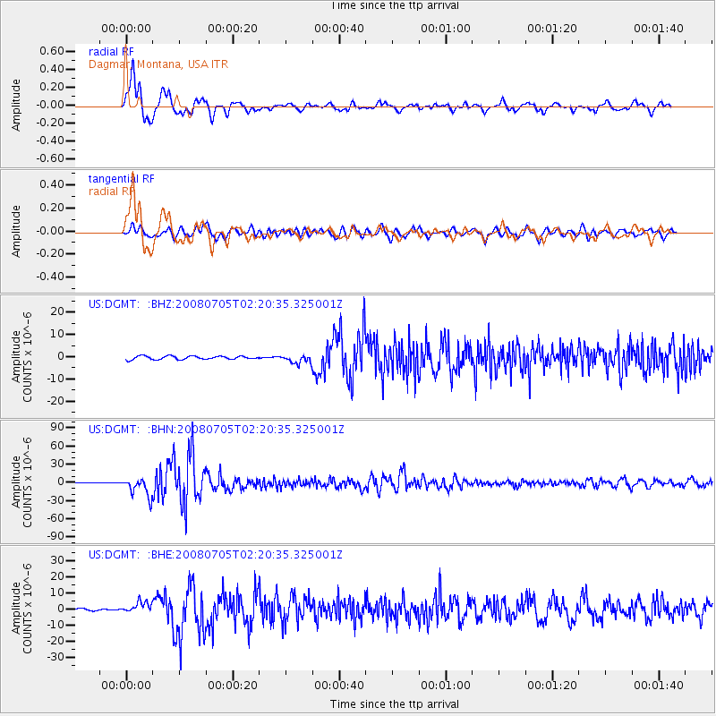
DGMT Dagmar, Montana, USA - Earthquake Result Viewer
*The percent match for this event was below the threshold and hence no stack was calculated.
| Earthquake location: |
Sea Of Okhotsk |
| Earthquake latitude/longitude: |
53.9/152.9 |
| Earthquake time(UTC): |
2008/07/05 (187) 02:12:04 GMT |
| Earthquake Depth: |
633 km |
| Earthquake Magnitude: |
6.8 MB, 7.7 MW, 7.7 MW |
| Earthquake Catalog/Contributor: |
WHDF/NEIC |
|
| Network: |
US United States National Seismic Network |
| Station: |
DGMT Dagmar, Montana, USA |
| Lat/Lon: |
48.47 N/104.20 W |
| Elevation: |
0.0 m |
|
| Distance: |
59.1 deg |
| Az: |
49.104 deg |
| Baz: |
317.743 deg |
| Ray Param: |
$rayparam |
*The percent match for this event was below the threshold and hence was not used in the summary stack. |
|
| Radial Match: |
94.74327 % |
| Radial Bump: |
400 |
| Transverse Match: |
82.85565 % |
| Transverse Bump: |
400 |
| SOD ConfigId: |
2504 |
| Insert Time: |
2010-03-05 01:28:42.156 +0000 |
| GWidth: |
2.5 |
| Max Bumps: |
400 |
| Tol: |
0.001 |
|
Signal To Noise
| Channel | StoN | STA | LTA |
| US:DGMT: :BHN:20080705T02:20:35.325001Z | 75.888214 | 1.5388126E-5 | 2.027736E-7 |
| US:DGMT: :BHE:20080705T02:20:35.325001Z | 4.6812744 | 3.405563E-6 | 7.274863E-7 |
| US:DGMT: :BHZ:20080705T02:20:35.325001Z | 2.4730992 | 1.8990385E-6 | 7.67878E-7 |
| Arrivals |
| Ps | |
| PpPs | |
| PsPs/PpSs | |


