You are here: Home > Network List > US - United States National Seismic Network Stations List
> Station DGMT Dagmar, Montana, USA > Earthquake Result Viewer
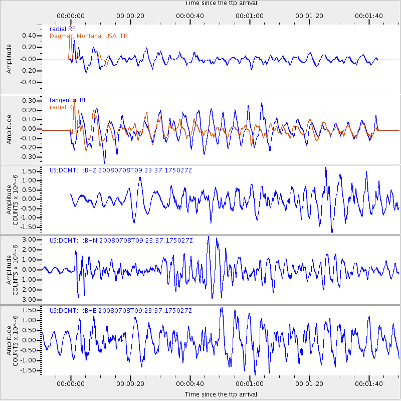
DGMT Dagmar, Montana, USA - Earthquake Result Viewer
*The percent match for this event was below the threshold and hence no stack was calculated.
| Earthquake location: |
Southern Peru |
| Earthquake latitude/longitude: |
-16.0/-71.7 |
| Earthquake time(UTC): |
2008/07/08 (190) 09:13:07 GMT |
| Earthquake Depth: |
123 km |
| Earthquake Magnitude: |
5.8 MB, 6.2 MW, 6.2 MW |
| Earthquake Catalog/Contributor: |
WHDF/NEIC |
|
| Network: |
US United States National Seismic Network |
| Station: |
DGMT Dagmar, Montana, USA |
| Lat/Lon: |
48.47 N/104.20 W |
| Elevation: |
0.0 m |
|
| Distance: |
70.4 deg |
| Az: |
337.723 deg |
| Baz: |
146.779 deg |
| Ray Param: |
$rayparam |
*The percent match for this event was below the threshold and hence was not used in the summary stack. |
|
| Radial Match: |
53.343678 % |
| Radial Bump: |
400 |
| Transverse Match: |
44.89396 % |
| Transverse Bump: |
400 |
| SOD ConfigId: |
2504 |
| Insert Time: |
2010-03-05 01:28:47.687 +0000 |
| GWidth: |
2.5 |
| Max Bumps: |
400 |
| Tol: |
0.001 |
|
Signal To Noise
| Channel | StoN | STA | LTA |
| US:DGMT: :BHN:20080708T09:23:37.175027Z | 8.306223 | 1.1080986E-6 | 1.3340582E-7 |
| US:DGMT: :BHE:20080708T09:23:37.175027Z | 1.9847783 | 5.622405E-7 | 2.8327622E-7 |
| US:DGMT: :BHZ:20080708T09:23:37.175027Z | 0.8910174 | 3.576722E-7 | 4.0141998E-7 |
| Arrivals |
| Ps | |
| PpPs | |
| PsPs/PpSs | |


