You are here: Home > Network List > US - United States National Seismic Network Stations List
> Station DGMT Dagmar, Montana, USA > Earthquake Result Viewer
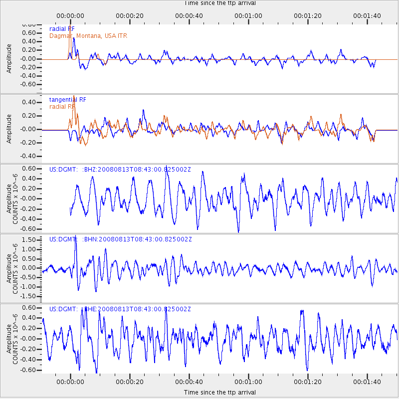
DGMT Dagmar, Montana, USA - Earthquake Result Viewer
*The percent match for this event was below the threshold and hence no stack was calculated.
| Earthquake location: |
North Of Severnaya Zemlya |
| Earthquake latitude/longitude: |
83.6/115.2 |
| Earthquake time(UTC): |
2008/08/13 (226) 08:35:02 GMT |
| Earthquake Depth: |
10 km |
| Earthquake Magnitude: |
5.5 MB, 4.7 MS, 5.4 MW, 5.4 MW |
| Earthquake Catalog/Contributor: |
WHDF/NEIC |
|
| Network: |
US United States National Seismic Network |
| Station: |
DGMT Dagmar, Montana, USA |
| Lat/Lon: |
48.47 N/104.20 W |
| Elevation: |
0.0 m |
|
| Distance: |
46.8 deg |
| Az: |
35.442 deg |
| Baz: |
354.425 deg |
| Ray Param: |
$rayparam |
*The percent match for this event was below the threshold and hence was not used in the summary stack. |
|
| Radial Match: |
72.46237 % |
| Radial Bump: |
400 |
| Transverse Match: |
55.73763 % |
| Transverse Bump: |
375 |
| SOD ConfigId: |
2504 |
| Insert Time: |
2010-03-05 01:29:00.591 +0000 |
| GWidth: |
2.5 |
| Max Bumps: |
400 |
| Tol: |
0.001 |
|
Signal To Noise
| Channel | StoN | STA | LTA |
| US:DGMT: :BHN:20080813T08:43:00.825002Z | 5.605311 | 6.405457E-7 | 1.1427479E-7 |
| US:DGMT: :BHE:20080813T08:43:00.825002Z | 1.742618 | 3.1804845E-7 | 1.8251187E-7 |
| US:DGMT: :BHZ:20080813T08:43:00.825002Z | 1.4910691 | 3.1645283E-7 | 2.1223217E-7 |
| Arrivals |
| Ps | |
| PpPs | |
| PsPs/PpSs | |


