You are here: Home > Network List > US - United States National Seismic Network Stations List
> Station DGMT Dagmar, Montana, USA > Earthquake Result Viewer
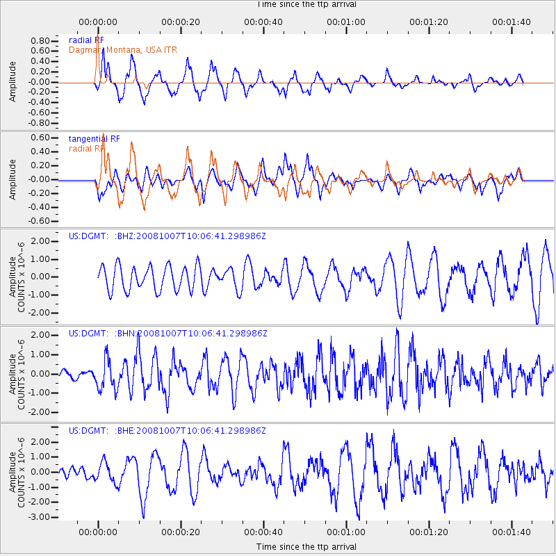
DGMT Dagmar, Montana, USA - Earthquake Result Viewer
*The percent match for this event was below the threshold and hence no stack was calculated.
| Earthquake location: |
Arctic Ocean |
| Earthquake latitude/longitude: |
79.8/-115.4 |
| Earthquake time(UTC): |
2008/10/07 (281) 10:00:48 GMT |
| Earthquake Depth: |
10 km |
| Earthquake Magnitude: |
5.6 MB, 5.5 MS, 5.7 MW, 5.7 MW |
| Earthquake Catalog/Contributor: |
WHDF/NEIC |
|
| Network: |
US United States National Seismic Network |
| Station: |
DGMT Dagmar, Montana, USA |
| Lat/Lon: |
48.47 N/104.20 W |
| Elevation: |
0.0 m |
|
| Distance: |
31.7 deg |
| Az: |
165.7 deg |
| Baz: |
356.213 deg |
| Ray Param: |
$rayparam |
*The percent match for this event was below the threshold and hence was not used in the summary stack. |
|
| Radial Match: |
72.19125 % |
| Radial Bump: |
400 |
| Transverse Match: |
62.43698 % |
| Transverse Bump: |
400 |
| SOD ConfigId: |
2556 |
| Insert Time: |
2010-03-05 01:29:04.142 +0000 |
| GWidth: |
2.5 |
| Max Bumps: |
400 |
| Tol: |
0.001 |
|
Signal To Noise
| Channel | StoN | STA | LTA |
| US:DGMT: :BHN:20081007T10:06:41.298986Z | 4.3147907 | 7.959434E-7 | 1.8446859E-7 |
| US:DGMT: :BHE:20081007T10:06:41.298986Z | 0.83444935 | 6.7893586E-7 | 8.136334E-7 |
| US:DGMT: :BHZ:20081007T10:06:41.298986Z | 0.8720011 | 5.8321876E-7 | 6.6882797E-7 |
| Arrivals |
| Ps | |
| PpPs | |
| PsPs/PpSs | |


