You are here: Home > Network List > US - United States National Seismic Network Stations List
> Station DGMT Dagmar, Montana, USA > Earthquake Result Viewer
DGMT Dagmar, Montana, USA - Earthquake Result Viewer
*The percent match for this event was below the threshold and hence no stack was calculated.
| Earthquake location: |
Tonga Islands |
| Earthquake latitude/longitude: |
-18.4/-175.4 |
| Earthquake time(UTC): |
2008/10/22 (296) 12:55:57 GMT |
| Earthquake Depth: |
233 km |
| Earthquake Magnitude: |
5.9 MB, 6.4 MW, 6.3 MW |
| Earthquake Catalog/Contributor: |
WHDF/NEIC |
|
| Network: |
US United States National Seismic Network |
| Station: |
DGMT Dagmar, Montana, USA |
| Lat/Lon: |
48.47 N/104.20 W |
| Elevation: |
0.0 m |
|
| Distance: |
91.7 deg |
| Az: |
39.059 deg |
| Baz: |
244.021 deg |
| Ray Param: |
$rayparam |
*The percent match for this event was below the threshold and hence was not used in the summary stack. |
|
| Radial Match: |
68.949165 % |
| Radial Bump: |
368 |
| Transverse Match: |
67.4857 % |
| Transverse Bump: |
400 |
| SOD ConfigId: |
2560 |
| Insert Time: |
2010-03-05 01:29:20.082 +0000 |
| GWidth: |
2.5 |
| Max Bumps: |
400 |
| Tol: |
0.001 |
|
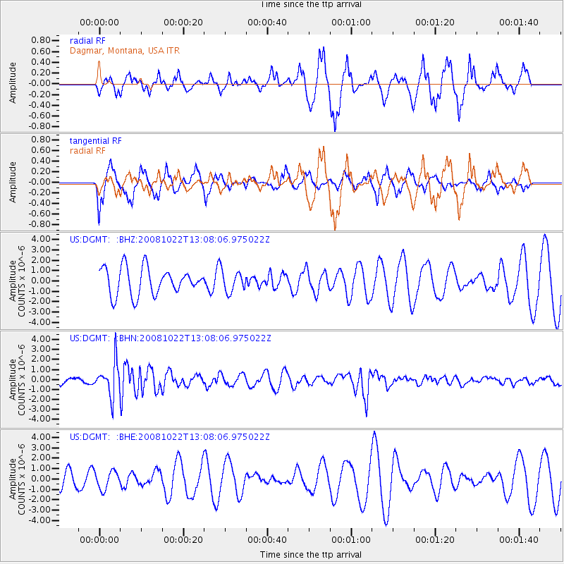
Signal To Noise
| Channel | StoN | STA | LTA |
| US:DGMT: :BHN:20081022T13:08:06.975022Z | 4.819437 | 1.7071817E-6 | 3.5422843E-7 |
| US:DGMT: :BHE:20081022T13:08:06.975022Z | 0.8980935 | 8.609272E-7 | 9.586164E-7 |
| US:DGMT: :BHZ:20081022T13:08:06.975022Z | 0.728308 | 9.4939884E-7 | 1.3035677E-6 |
| Arrivals |
| Ps | |
| PpPs | |
| PsPs/PpSs | |


