You are here: Home > Network List > US - United States National Seismic Network Stations List
> Station DGMT Dagmar, Montana, USA > Earthquake Result Viewer
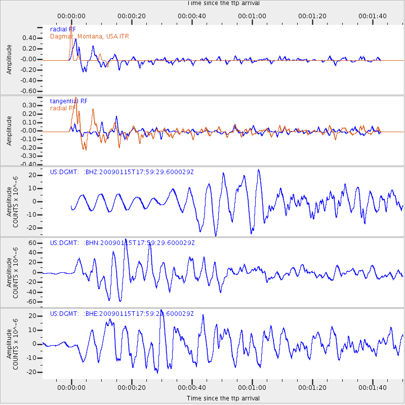
DGMT Dagmar, Montana, USA - Earthquake Result Viewer
*The percent match for this event was below the threshold and hence no stack was calculated.
| Earthquake location: |
East Of Kuril Islands |
| Earthquake latitude/longitude: |
46.9/155.2 |
| Earthquake time(UTC): |
2009/01/15 (015) 17:49:39 GMT |
| Earthquake Depth: |
36 km |
| Earthquake Magnitude: |
6.9 MB, 7.5 MS, 7.4 MW, 7.4 MW |
| Earthquake Catalog/Contributor: |
WHDF/NEIC |
|
| Network: |
US United States National Seismic Network |
| Station: |
DGMT Dagmar, Montana, USA |
| Lat/Lon: |
48.47 N/104.20 W |
| Elevation: |
0.0 m |
|
| Distance: |
62.7 deg |
| Az: |
47.387 deg |
| Baz: |
310.632 deg |
| Ray Param: |
$rayparam |
*The percent match for this event was below the threshold and hence was not used in the summary stack. |
|
| Radial Match: |
95.3742 % |
| Radial Bump: |
400 |
| Transverse Match: |
85.71884 % |
| Transverse Bump: |
400 |
| SOD ConfigId: |
2834 |
| Insert Time: |
2010-03-05 01:29:20.878 +0000 |
| GWidth: |
2.5 |
| Max Bumps: |
400 |
| Tol: |
0.001 |
|
Signal To Noise
| Channel | StoN | STA | LTA |
| US:DGMT: :BHN:20090115T17:59:29.600029Z | 23.247864 | 1.354756E-5 | 5.827443E-7 |
| US:DGMT: :BHE:20090115T17:59:29.600029Z | 2.8788161 | 6.141572E-6 | 2.1333674E-6 |
| US:DGMT: :BHZ:20090115T17:59:29.600029Z | 1.3192719 | 5.567504E-6 | 4.2201336E-6 |
| Arrivals |
| Ps | |
| PpPs | |
| PsPs/PpSs | |


