You are here: Home > Network List > US - United States National Seismic Network Stations List
> Station DGMT Dagmar, Montana, USA > Earthquake Result Viewer
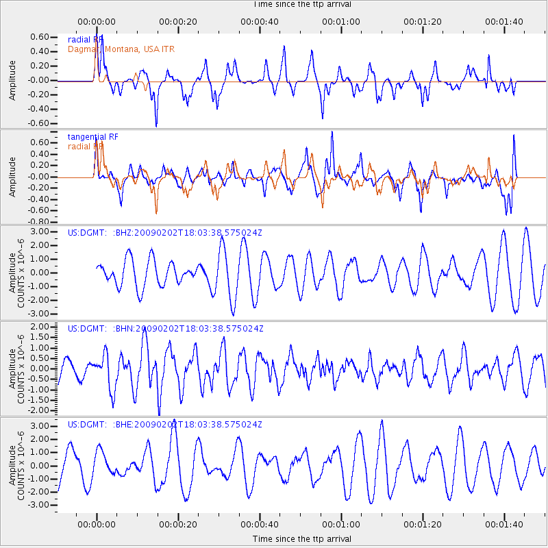
DGMT Dagmar, Montana, USA - Earthquake Result Viewer
*The percent match for this event was below the threshold and hence no stack was calculated.
| Earthquake location: |
Near Coast Of Peru |
| Earthquake latitude/longitude: |
-13.6/-76.6 |
| Earthquake time(UTC): |
2009/02/02 (033) 17:53:21 GMT |
| Earthquake Depth: |
21 km |
| Earthquake Magnitude: |
5.6 MB, 5.6 MS, 6.0 MW, 5.9 MW |
| Earthquake Catalog/Contributor: |
WHDF/NEIC |
|
| Network: |
US United States National Seismic Network |
| Station: |
DGMT Dagmar, Montana, USA |
| Lat/Lon: |
48.47 N/104.20 W |
| Elevation: |
0.0 m |
|
| Distance: |
66.5 deg |
| Az: |
340.325 deg |
| Baz: |
150.531 deg |
| Ray Param: |
$rayparam |
*The percent match for this event was below the threshold and hence was not used in the summary stack. |
|
| Radial Match: |
57.71902 % |
| Radial Bump: |
336 |
| Transverse Match: |
61.619076 % |
| Transverse Bump: |
355 |
| SOD ConfigId: |
6627 |
| Insert Time: |
2010-03-05 01:29:23.820 +0000 |
| GWidth: |
2.5 |
| Max Bumps: |
400 |
| Tol: |
0.001 |
|
Signal To Noise
| Channel | StoN | STA | LTA |
| US:DGMT: :BHN:20090202T18:03:38.575024Z | 2.3113177 | 8.5369015E-7 | 3.6935214E-7 |
| US:DGMT: :BHE:20090202T18:03:38.575024Z | 0.7314037 | 8.7604565E-7 | 1.1977594E-6 |
| US:DGMT: :BHZ:20090202T18:03:38.575024Z | 2.0925808 | 1.8661111E-6 | 8.9177496E-7 |
| Arrivals |
| Ps | |
| PpPs | |
| PsPs/PpSs | |


