You are here: Home > Network List > US - United States National Seismic Network Stations List
> Station DGMT Dagmar, Montana, USA > Earthquake Result Viewer
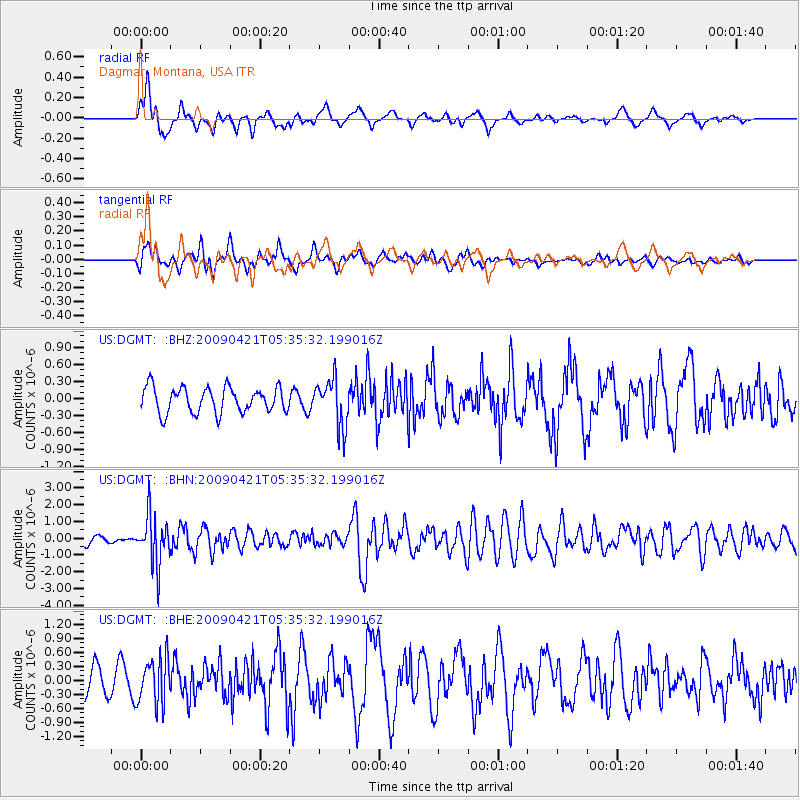
DGMT Dagmar, Montana, USA - Earthquake Result Viewer
*The percent match for this event was below the threshold and hence no stack was calculated.
| Earthquake location: |
Kuril Islands |
| Earthquake latitude/longitude: |
50.8/155.0 |
| Earthquake time(UTC): |
2009/04/21 (111) 05:26:11 GMT |
| Earthquake Depth: |
152 km |
| Earthquake Magnitude: |
6.0 MB, 6.2 MW, 6.2 MW |
| Earthquake Catalog/Contributor: |
WHDF/NEIC |
|
| Network: |
US United States National Seismic Network |
| Station: |
DGMT Dagmar, Montana, USA |
| Lat/Lon: |
48.47 N/104.20 W |
| Elevation: |
0.0 m |
|
| Distance: |
60.1 deg |
| Az: |
48.929 deg |
| Baz: |
314.081 deg |
| Ray Param: |
$rayparam |
*The percent match for this event was below the threshold and hence was not used in the summary stack. |
|
| Radial Match: |
65.49727 % |
| Radial Bump: |
400 |
| Transverse Match: |
52.691124 % |
| Transverse Bump: |
400 |
| SOD ConfigId: |
2760 |
| Insert Time: |
2010-03-05 01:29:25.390 +0000 |
| GWidth: |
2.5 |
| Max Bumps: |
400 |
| Tol: |
0.001 |
|
Signal To Noise
| Channel | StoN | STA | LTA |
| US:DGMT: :BHN:20090421T05:35:32.199016Z | 9.089471 | 1.4536846E-6 | 1.5993062E-7 |
| US:DGMT: :BHE:20090421T05:35:32.199016Z | 1.9249384 | 4.9424676E-7 | 2.5675976E-7 |
| US:DGMT: :BHZ:20090421T05:35:32.199016Z | 1.8611796 | 4.1640465E-7 | 2.2373159E-7 |
| Arrivals |
| Ps | |
| PpPs | |
| PsPs/PpSs | |


