You are here: Home > Network List > US - United States National Seismic Network Stations List
> Station DGMT Dagmar, Montana, USA > Earthquake Result Viewer
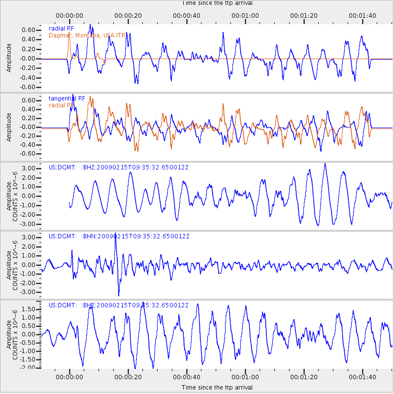
DGMT Dagmar, Montana, USA - Earthquake Result Viewer
*The percent match for this event was below the threshold and hence no stack was calculated.
| Earthquake location: |
Near East Coast Of Honshu, Japan |
| Earthquake latitude/longitude: |
40.2/142.2 |
| Earthquake time(UTC): |
2009/02/15 (046) 09:24:31 GMT |
| Earthquake Depth: |
33 km |
| Earthquake Magnitude: |
6.1 MB, 5.5 MS, 5.7 MW, 5.7 MW |
| Earthquake Catalog/Contributor: |
WHDF/NEIC |
|
| Network: |
US United States National Seismic Network |
| Station: |
DGMT Dagmar, Montana, USA |
| Lat/Lon: |
48.47 N/104.20 W |
| Elevation: |
0.0 m |
|
| Distance: |
73.9 deg |
| Az: |
39.401 deg |
| Baz: |
313.104 deg |
| Ray Param: |
$rayparam |
*The percent match for this event was below the threshold and hence was not used in the summary stack. |
|
| Radial Match: |
50.987797 % |
| Radial Bump: |
335 |
| Transverse Match: |
59.926945 % |
| Transverse Bump: |
400 |
| SOD ConfigId: |
2658 |
| Insert Time: |
2010-03-05 01:29:26.269 +0000 |
| GWidth: |
2.5 |
| Max Bumps: |
400 |
| Tol: |
0.001 |
|
Signal To Noise
| Channel | StoN | STA | LTA |
| US:DGMT: :BHN:20090215T09:35:32.650012Z | 2.3495924 | 7.305301E-7 | 3.1091778E-7 |
| US:DGMT: :BHE:20090215T09:35:32.650012Z | 0.82062733 | 8.491852E-7 | 1.0348001E-6 |
| US:DGMT: :BHZ:20090215T09:35:32.650012Z | 1.0050211 | 1.2527139E-6 | 1.2464554E-6 |
| Arrivals |
| Ps | |
| PpPs | |
| PsPs/PpSs | |


