You are here: Home > Network List > US - United States National Seismic Network Stations List
> Station DGMT Dagmar, Montana, USA > Earthquake Result Viewer
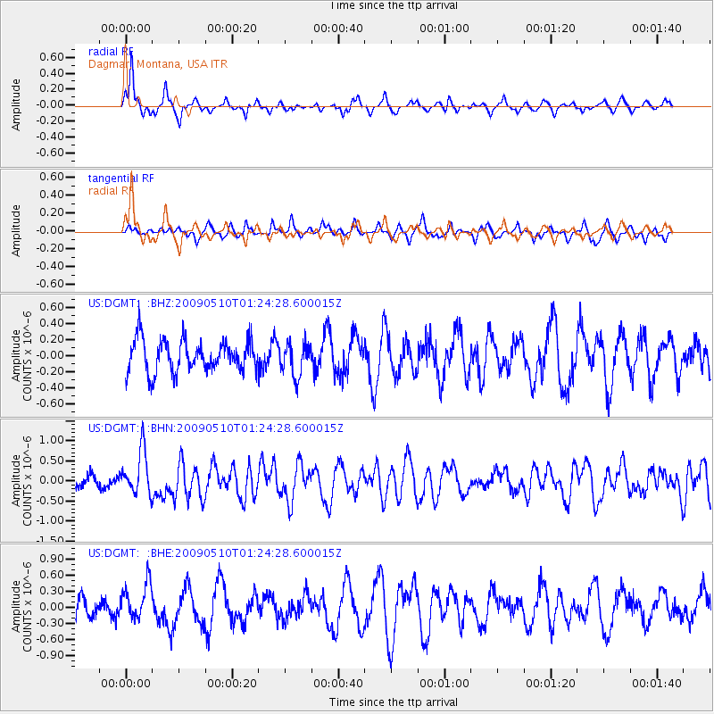
DGMT Dagmar, Montana, USA - Earthquake Result Viewer
*The percent match for this event was below the threshold and hence no stack was calculated.
| Earthquake location: |
Off Coast Of Ecuador |
| Earthquake latitude/longitude: |
1.4/-85.2 |
| Earthquake time(UTC): |
2009/05/10 (130) 01:16:06 GMT |
| Earthquake Depth: |
6.0 km |
| Earthquake Magnitude: |
5.5 MB, 5.7 MS, 6.1 MW, 6.1 MW |
| Earthquake Catalog/Contributor: |
WHDF/NEIC |
|
| Network: |
US United States National Seismic Network |
| Station: |
DGMT Dagmar, Montana, USA |
| Lat/Lon: |
48.47 N/104.20 W |
| Elevation: |
0.0 m |
|
| Distance: |
49.7 deg |
| Az: |
343.469 deg |
| Baz: |
154.696 deg |
| Ray Param: |
$rayparam |
*The percent match for this event was below the threshold and hence was not used in the summary stack. |
|
| Radial Match: |
74.2167 % |
| Radial Bump: |
313 |
| Transverse Match: |
55.850388 % |
| Transverse Bump: |
364 |
| SOD ConfigId: |
2760 |
| Insert Time: |
2010-03-05 01:29:29.467 +0000 |
| GWidth: |
2.5 |
| Max Bumps: |
400 |
| Tol: |
0.001 |
|
Signal To Noise
| Channel | StoN | STA | LTA |
| US:DGMT: :BHN:20090510T01:24:28.600015Z | 4.0467157 | 5.4898715E-7 | 1.3566239E-7 |
| US:DGMT: :BHE:20090510T01:24:28.600015Z | 1.6099058 | 3.3934546E-7 | 2.1078591E-7 |
| US:DGMT: :BHZ:20090510T01:24:28.600015Z | 1.0555898 | 2.0631987E-7 | 1.9545459E-7 |
| Arrivals |
| Ps | |
| PpPs | |
| PsPs/PpSs | |


