You are here: Home > Network List > US - United States National Seismic Network Stations List
> Station DGMT Dagmar, Montana, USA > Earthquake Result Viewer
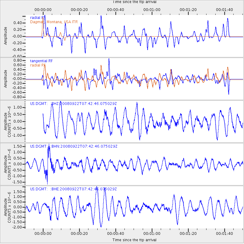
DGMT Dagmar, Montana, USA - Earthquake Result Viewer
*The percent match for this event was below the threshold and hence no stack was calculated.
| Earthquake location: |
Hokkaido, Japan Region |
| Earthquake latitude/longitude: |
41.6/140.4 |
| Earthquake time(UTC): |
2008/09/22 (266) 07:31:59 GMT |
| Earthquake Depth: |
149 km |
| Earthquake Magnitude: |
5.7 MW, 5.3 MB, 5.6 MW |
| Earthquake Catalog/Contributor: |
WHDF/NEIC |
|
| Network: |
US United States National Seismic Network |
| Station: |
DGMT Dagmar, Montana, USA |
| Lat/Lon: |
48.47 N/104.20 W |
| Elevation: |
0.0 m |
|
| Distance: |
73.8 deg |
| Az: |
38.784 deg |
| Baz: |
315.076 deg |
| Ray Param: |
$rayparam |
*The percent match for this event was below the threshold and hence was not used in the summary stack. |
|
| Radial Match: |
64.44409 % |
| Radial Bump: |
400 |
| Transverse Match: |
54.340164 % |
| Transverse Bump: |
400 |
| SOD ConfigId: |
2560 |
| Insert Time: |
2010-03-05 01:29:44.530 +0000 |
| GWidth: |
2.5 |
| Max Bumps: |
400 |
| Tol: |
0.001 |
|
Signal To Noise
| Channel | StoN | STA | LTA |
| US:DGMT: :BHN:20080922T07:42:46.075029Z | 3.587862 | 7.856971E-7 | 2.1898755E-7 |
| US:DGMT: :BHE:20080922T07:42:46.075029Z | 0.84253865 | 4.567746E-7 | 5.421408E-7 |
| US:DGMT: :BHZ:20080922T07:42:46.075029Z | 0.83142424 | 5.4787387E-7 | 6.589583E-7 |
| Arrivals |
| Ps | |
| PpPs | |
| PsPs/PpSs | |


