You are here: Home > Network List > US - United States National Seismic Network Stations List
> Station DGMT Dagmar, Montana, USA > Earthquake Result Viewer
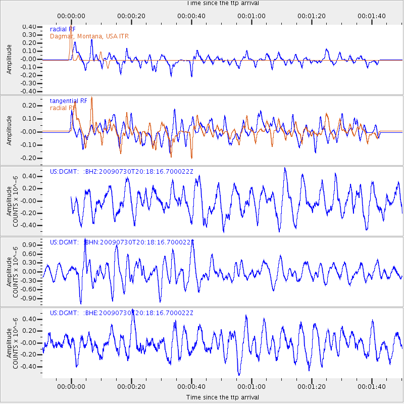
DGMT Dagmar, Montana, USA - Earthquake Result Viewer
*The percent match for this event was below the threshold and hence no stack was calculated.
| Earthquake location: |
Tonga Islands |
| Earthquake latitude/longitude: |
-20.8/-174.3 |
| Earthquake time(UTC): |
2009/07/30 (211) 20:05:34 GMT |
| Earthquake Depth: |
10 km |
| Earthquake Magnitude: |
5.9 MB, 5.7 MS, 5.8 MW, 5.7 MW |
| Earthquake Catalog/Contributor: |
WHDF/NEIC |
|
| Network: |
US United States National Seismic Network |
| Station: |
DGMT Dagmar, Montana, USA |
| Lat/Lon: |
48.47 N/104.20 W |
| Elevation: |
0.0 m |
|
| Distance: |
93.0 deg |
| Az: |
38.788 deg |
| Baz: |
241.692 deg |
| Ray Param: |
$rayparam |
*The percent match for this event was below the threshold and hence was not used in the summary stack. |
|
| Radial Match: |
56.407654 % |
| Radial Bump: |
338 |
| Transverse Match: |
58.64297 % |
| Transverse Bump: |
400 |
| SOD ConfigId: |
2622 |
| Insert Time: |
2010-03-05 01:29:50.064 +0000 |
| GWidth: |
2.5 |
| Max Bumps: |
400 |
| Tol: |
0.001 |
|
Signal To Noise
| Channel | StoN | STA | LTA |
| US:DGMT: :BHN:20090730T20:18:16.700022Z | 3.8879905 | 4.7873834E-7 | 1.231326E-7 |
| US:DGMT: :BHE:20090730T20:18:16.700022Z | 0.80388725 | 1.5273723E-7 | 1.8999833E-7 |
| US:DGMT: :BHZ:20090730T20:18:16.700022Z | 0.7759158 | 1.437163E-7 | 1.8522152E-7 |
| Arrivals |
| Ps | |
| PpPs | |
| PsPs/PpSs | |


