You are here: Home > Network List > US - United States National Seismic Network Stations List
> Station DGMT Dagmar, Montana, USA > Earthquake Result Viewer
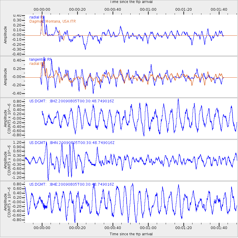
DGMT Dagmar, Montana, USA - Earthquake Result Viewer
*The percent match for this event was below the threshold and hence no stack was calculated.
| Earthquake location: |
Southwestern Ryukyu Isl., Japan |
| Earthquake latitude/longitude: |
24.2/125.1 |
| Earthquake time(UTC): |
2009/08/05 (217) 00:17:58 GMT |
| Earthquake Depth: |
25 km |
| Earthquake Magnitude: |
5.9 MB, 5.9 MS, 6.2 MW, 6.1 MW |
| Earthquake Catalog/Contributor: |
WHDF/NEIC |
|
| Network: |
US United States National Seismic Network |
| Station: |
DGMT Dagmar, Montana, USA |
| Lat/Lon: |
48.47 N/104.20 W |
| Elevation: |
0.0 m |
|
| Distance: |
95.3 deg |
| Az: |
30.437 deg |
| Baz: |
315.978 deg |
| Ray Param: |
$rayparam |
*The percent match for this event was below the threshold and hence was not used in the summary stack. |
|
| Radial Match: |
71.289795 % |
| Radial Bump: |
400 |
| Transverse Match: |
70.12949 % |
| Transverse Bump: |
337 |
| SOD ConfigId: |
2622 |
| Insert Time: |
2010-03-05 01:29:53.380 +0000 |
| GWidth: |
2.5 |
| Max Bumps: |
400 |
| Tol: |
0.001 |
|
Signal To Noise
| Channel | StoN | STA | LTA |
| US:DGMT: :BHN:20090805T00:30:48.749016Z | 4.172085 | 6.28917E-7 | 1.5074406E-7 |
| US:DGMT: :BHE:20090805T00:30:48.749016Z | 0.7043459 | 2.112748E-7 | 2.9995886E-7 |
| US:DGMT: :BHZ:20090805T00:30:48.749016Z | 1.2076511 | 3.400702E-7 | 2.8159636E-7 |
| Arrivals |
| Ps | |
| PpPs | |
| PsPs/PpSs | |


