You are here: Home > Network List > TA - USArray Transportable Network (new EarthScope stations) Stations List
> Station O03E Paynes Creek, CA, USA > Earthquake Result Viewer
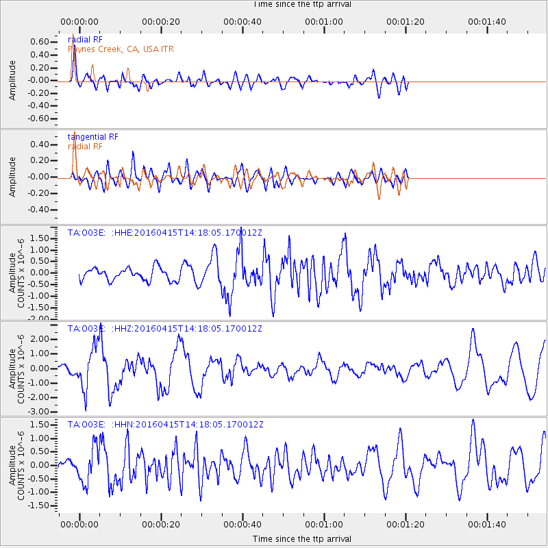
O03E Paynes Creek, CA, USA - Earthquake Result Viewer
*The percent match for this event was below the threshold and hence no stack was calculated.
| Earthquake location: |
Off Coast Of Chiapas, Mexico |
| Earthquake latitude/longitude: |
13.5/-92.2 |
| Earthquake time(UTC): |
2016/04/15 (106) 14:11:29 GMT |
| Earthquake Depth: |
48 km |
| Earthquake Magnitude: |
6.2 MWP |
| Earthquake Catalog/Contributor: |
NEIC PDE/NEIC COMCAT |
|
| Network: |
TA USArray Transportable Network (new EarthScope stations) |
| Station: |
O03E Paynes Creek, CA, USA |
| Lat/Lon: |
40.29 N/121.80 W |
| Elevation: |
967 m |
|
| Distance: |
37.3 deg |
| Az: |
321.336 deg |
| Baz: |
127.382 deg |
| Ray Param: |
$rayparam |
*The percent match for this event was below the threshold and hence was not used in the summary stack. |
|
| Radial Match: |
65.924706 % |
| Radial Bump: |
400 |
| Transverse Match: |
63.13779 % |
| Transverse Bump: |
400 |
| SOD ConfigId: |
7422571 |
| Insert Time: |
2019-04-22 07:03:12.693 +0000 |
| GWidth: |
2.5 |
| Max Bumps: |
400 |
| Tol: |
0.001 |
|
Signal To Noise
| Channel | StoN | STA | LTA |
| TA:O03E: :HHZ:20160415T14:18:05.170012Z | 8.54207 | 1.4411747E-6 | 1.6871492E-7 |
| TA:O03E: :HHN:20160415T14:18:05.170012Z | 1.8133754 | 6.421909E-7 | 3.5414118E-7 |
| TA:O03E: :HHE:20160415T14:18:05.170012Z | 2.7584624 | 7.7035827E-7 | 2.7927092E-7 |
| Arrivals |
| Ps | |
| PpPs | |
| PsPs/PpSs | |


