You are here: Home > Network List > US - United States National Seismic Network Stations List
> Station DGMT Dagmar, Montana, USA > Earthquake Result Viewer
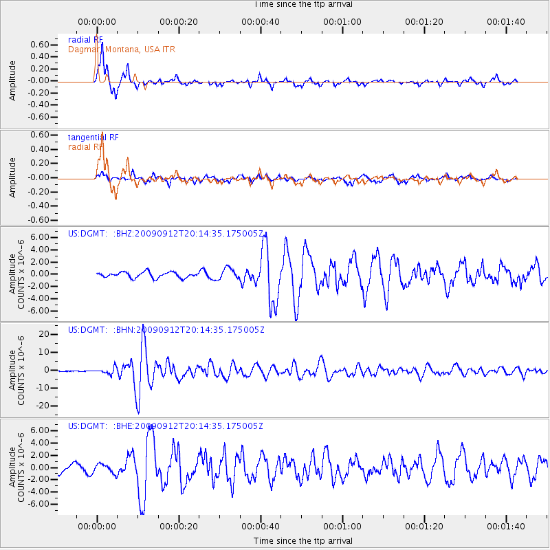
DGMT Dagmar, Montana, USA - Earthquake Result Viewer
*The percent match for this event was below the threshold and hence no stack was calculated.
| Earthquake location: |
Near Coast Of Venezuela |
| Earthquake latitude/longitude: |
10.7/-67.9 |
| Earthquake time(UTC): |
2009/09/12 (255) 20:06:24 GMT |
| Earthquake Depth: |
10 km |
| Earthquake Magnitude: |
6.3 MB, 6.4 MS, 6.3 MW, 6.3 MW |
| Earthquake Catalog/Contributor: |
WHDF/NEIC |
|
| Network: |
US United States National Seismic Network |
| Station: |
DGMT Dagmar, Montana, USA |
| Lat/Lon: |
48.47 N/104.20 W |
| Elevation: |
0.0 m |
|
| Distance: |
48.3 deg |
| Az: |
328.18 deg |
| Baz: |
128.862 deg |
| Ray Param: |
$rayparam |
*The percent match for this event was below the threshold and hence was not used in the summary stack. |
|
| Radial Match: |
94.559814 % |
| Radial Bump: |
305 |
| Transverse Match: |
71.65488 % |
| Transverse Bump: |
400 |
| SOD ConfigId: |
2622 |
| Insert Time: |
2010-03-05 01:30:20.260 +0000 |
| GWidth: |
2.5 |
| Max Bumps: |
400 |
| Tol: |
0.001 |
|
Signal To Noise
| Channel | StoN | STA | LTA |
| US:DGMT: :BHN:20090912T20:14:35.175005Z | 9.212732 | 1.7110841E-6 | 1.8573036E-7 |
| US:DGMT: :BHE:20090912T20:14:35.175005Z | 0.89244616 | 7.455233E-7 | 8.3537066E-7 |
| US:DGMT: :BHZ:20090912T20:14:35.175005Z | 1.9680654 | 9.088954E-7 | 4.6182174E-7 |
| Arrivals |
| Ps | |
| PpPs | |
| PsPs/PpSs | |


