You are here: Home > Network List > US - United States National Seismic Network Stations List
> Station DGMT Dagmar, Montana, USA > Earthquake Result Viewer
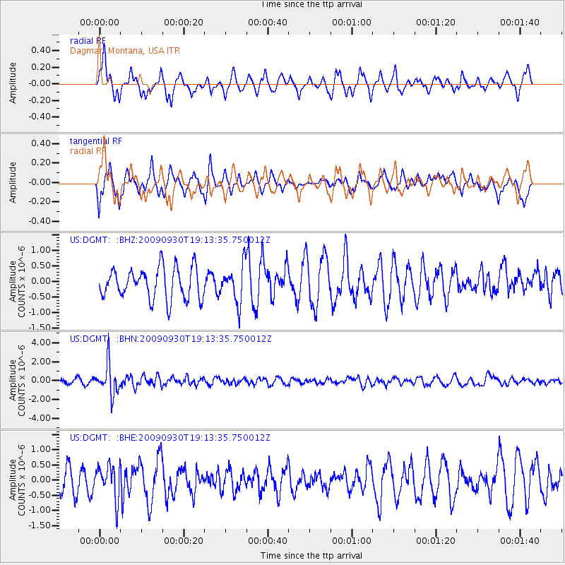
DGMT Dagmar, Montana, USA - Earthquake Result Viewer
*The percent match for this event was below the threshold and hence no stack was calculated.
| Earthquake location: |
Peru-Bolivia Border Region |
| Earthquake latitude/longitude: |
-15.6/-69.3 |
| Earthquake time(UTC): |
2009/09/30 (273) 19:03:17 GMT |
| Earthquake Depth: |
255 km |
| Earthquake Magnitude: |
5.9 MB, 5.8 MW |
| Earthquake Catalog/Contributor: |
WHDF/NEIC |
|
| Network: |
US United States National Seismic Network |
| Station: |
DGMT Dagmar, Montana, USA |
| Lat/Lon: |
48.47 N/104.20 W |
| Elevation: |
0.0 m |
|
| Distance: |
70.9 deg |
| Az: |
336.236 deg |
| Baz: |
144.294 deg |
| Ray Param: |
$rayparam |
*The percent match for this event was below the threshold and hence was not used in the summary stack. |
|
| Radial Match: |
67.56178 % |
| Radial Bump: |
351 |
| Transverse Match: |
44.32837 % |
| Transverse Bump: |
331 |
| SOD ConfigId: |
2622 |
| Insert Time: |
2010-03-05 01:30:24.136 +0000 |
| GWidth: |
2.5 |
| Max Bumps: |
400 |
| Tol: |
0.001 |
|
Signal To Noise
| Channel | StoN | STA | LTA |
| US:DGMT: :BHN:20090930T19:13:35.750012Z | 7.056022 | 1.6427862E-6 | 2.3282043E-7 |
| US:DGMT: :BHE:20090930T19:13:35.750012Z | 1.0782847 | 5.6823586E-7 | 5.2698124E-7 |
| US:DGMT: :BHZ:20090930T19:13:35.750012Z | 1.2207075 | 6.0605555E-7 | 4.964789E-7 |
| Arrivals |
| Ps | |
| PpPs | |
| PsPs/PpSs | |


