You are here: Home > Network List > UW - Pacific Northwest Regional Seismic Network Stations List
> Station MRBL Marblemount, WA, USA > Earthquake Result Viewer
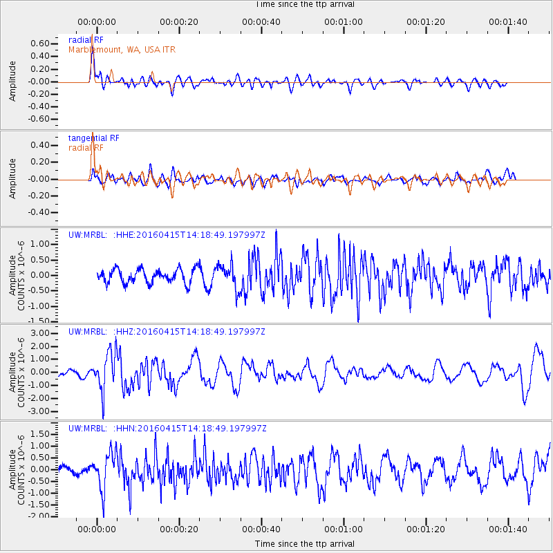
MRBL Marblemount, WA, USA - Earthquake Result Viewer
*The percent match for this event was below the threshold and hence no stack was calculated.
| Earthquake location: |
Off Coast Of Chiapas, Mexico |
| Earthquake latitude/longitude: |
13.5/-92.2 |
| Earthquake time(UTC): |
2016/04/15 (106) 14:11:29 GMT |
| Earthquake Depth: |
48 km |
| Earthquake Magnitude: |
6.2 MWP |
| Earthquake Catalog/Contributor: |
NEIC PDE/NEIC COMCAT |
|
| Network: |
UW Pacific Northwest Regional Seismic Network |
| Station: |
MRBL Marblemount, WA, USA |
| Lat/Lon: |
48.52 N/121.48 W |
| Elevation: |
75 m |
|
| Distance: |
42.5 deg |
| Az: |
331.207 deg |
| Baz: |
135.192 deg |
| Ray Param: |
$rayparam |
*The percent match for this event was below the threshold and hence was not used in the summary stack. |
|
| Radial Match: |
72.44002 % |
| Radial Bump: |
400 |
| Transverse Match: |
74.2613 % |
| Transverse Bump: |
400 |
| SOD ConfigId: |
7422571 |
| Insert Time: |
2019-04-22 07:03:47.821 +0000 |
| GWidth: |
2.5 |
| Max Bumps: |
400 |
| Tol: |
0.001 |
|
Signal To Noise
| Channel | StoN | STA | LTA |
| UW:MRBL: :HHZ:20160415T14:18:49.197997Z | 4.4787593 | 1.5195412E-6 | 3.3927728E-7 |
| UW:MRBL: :HHN:20160415T14:18:49.197997Z | 3.4240925 | 8.0931005E-7 | 2.3635754E-7 |
| UW:MRBL: :HHE:20160415T14:18:49.197997Z | 1.8885489 | 4.3633767E-7 | 2.3104388E-7 |
| Arrivals |
| Ps | |
| PpPs | |
| PsPs/PpSs | |


