You are here: Home > Network List > US - United States National Seismic Network Stations List
> Station DGMT Dagmar, Montana, USA > Earthquake Result Viewer
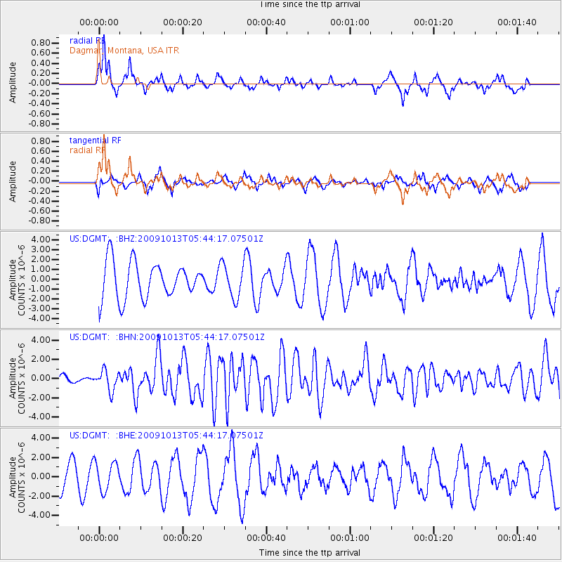
DGMT Dagmar, Montana, USA - Earthquake Result Viewer
*The percent match for this event was below the threshold and hence no stack was calculated.
| Earthquake location: |
Fox Islands, Aleutian Islands |
| Earthquake latitude/longitude: |
52.8/-167.0 |
| Earthquake time(UTC): |
2009/10/13 (286) 05:37:23 GMT |
| Earthquake Depth: |
24 km |
| Earthquake Magnitude: |
6.0 MB, 6.1 MS, 6.5 MW, 6.5 MW |
| Earthquake Catalog/Contributor: |
WHDF/NEIC |
|
| Network: |
US United States National Seismic Network |
| Station: |
DGMT Dagmar, Montana, USA |
| Lat/Lon: |
48.47 N/104.20 W |
| Elevation: |
0.0 m |
|
| Distance: |
39.0 deg |
| Az: |
70.284 deg |
| Baz: |
300.709 deg |
| Ray Param: |
$rayparam |
*The percent match for this event was below the threshold and hence was not used in the summary stack. |
|
| Radial Match: |
64.718445 % |
| Radial Bump: |
312 |
| Transverse Match: |
49.81992 % |
| Transverse Bump: |
349 |
| SOD ConfigId: |
2622 |
| Insert Time: |
2010-03-05 01:30:28.547 +0000 |
| GWidth: |
2.5 |
| Max Bumps: |
400 |
| Tol: |
0.001 |
|
Signal To Noise
| Channel | StoN | STA | LTA |
| US:DGMT: :BHN:20091013T05:44:17.07501Z | 3.0249019 | 1.0677832E-6 | 3.5299763E-7 |
| US:DGMT: :BHE:20091013T05:44:17.07501Z | 0.7729972 | 1.4137835E-6 | 1.8289633E-6 |
| US:DGMT: :BHZ:20091013T05:44:17.07501Z | 0.9576366 | 1.7627768E-6 | 1.8407577E-6 |
| Arrivals |
| Ps | |
| PpPs | |
| PsPs/PpSs | |


