You are here: Home > Network List > US - United States National Seismic Network Stations List
> Station DGMT Dagmar, Montana, USA > Earthquake Result Viewer
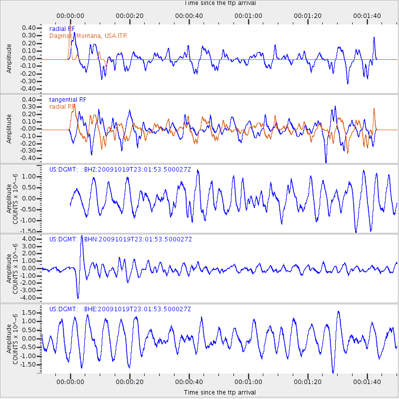
DGMT Dagmar, Montana, USA - Earthquake Result Viewer
*The percent match for this event was below the threshold and hence no stack was calculated.
| Earthquake location: |
Samoa Islands Region |
| Earthquake latitude/longitude: |
-15.4/-172.3 |
| Earthquake time(UTC): |
2009/10/19 (292) 22:49:38 GMT |
| Earthquake Depth: |
18 km |
| Earthquake Magnitude: |
6.2 MB, 5.7 MS, 6.0 MW, 5.9 MW |
| Earthquake Catalog/Contributor: |
WHDF/NEIC |
|
| Network: |
US United States National Seismic Network |
| Station: |
DGMT Dagmar, Montana, USA |
| Lat/Lon: |
48.47 N/104.20 W |
| Elevation: |
0.0 m |
|
| Distance: |
87.5 deg |
| Az: |
38.165 deg |
| Baz: |
243.606 deg |
| Ray Param: |
$rayparam |
*The percent match for this event was below the threshold and hence was not used in the summary stack. |
|
| Radial Match: |
56.431244 % |
| Radial Bump: |
400 |
| Transverse Match: |
70.931915 % |
| Transverse Bump: |
400 |
| SOD ConfigId: |
2622 |
| Insert Time: |
2010-03-05 01:30:32.458 +0000 |
| GWidth: |
2.5 |
| Max Bumps: |
400 |
| Tol: |
0.001 |
|
Signal To Noise
| Channel | StoN | STA | LTA |
| US:DGMT: :BHN:20091019T23:01:53.500027Z | 7.679398 | 2.1072872E-6 | 2.7440785E-7 |
| US:DGMT: :BHE:20091019T23:01:53.500027Z | 1.7002809 | 9.785423E-7 | 5.7551796E-7 |
| US:DGMT: :BHZ:20091019T23:01:53.500027Z | 0.6862731 | 3.3069898E-7 | 4.818766E-7 |
| Arrivals |
| Ps | |
| PpPs | |
| PsPs/PpSs | |


