You are here: Home > Network List > US - United States National Seismic Network Stations List
> Station DGMT Dagmar, Montana, USA > Earthquake Result Viewer
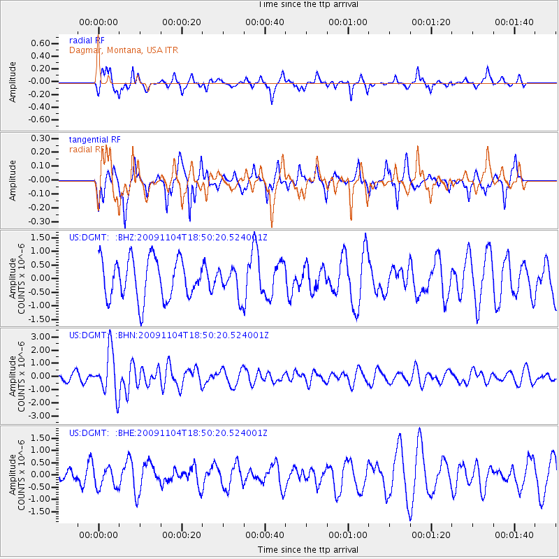
DGMT Dagmar, Montana, USA - Earthquake Result Viewer
*The percent match for this event was below the threshold and hence no stack was calculated.
| Earthquake location: |
Azores Islands Region |
| Earthquake latitude/longitude: |
36.2/-33.9 |
| Earthquake time(UTC): |
2009/11/04 (308) 18:41:44 GMT |
| Earthquake Depth: |
10 km |
| Earthquake Magnitude: |
5.7 MB, 5.6 MS, 5.9 MW, 5.8 MW |
| Earthquake Catalog/Contributor: |
WHDF/NEIC |
|
| Network: |
US United States National Seismic Network |
| Station: |
DGMT Dagmar, Montana, USA |
| Lat/Lon: |
48.47 N/104.20 W |
| Elevation: |
0.0 m |
|
| Distance: |
51.7 deg |
| Az: |
307.014 deg |
| Baz: |
76.178 deg |
| Ray Param: |
$rayparam |
*The percent match for this event was below the threshold and hence was not used in the summary stack. |
|
| Radial Match: |
60.546505 % |
| Radial Bump: |
321 |
| Transverse Match: |
69.602936 % |
| Transverse Bump: |
349 |
| SOD ConfigId: |
2622 |
| Insert Time: |
2010-03-05 01:30:41.061 +0000 |
| GWidth: |
2.5 |
| Max Bumps: |
400 |
| Tol: |
0.001 |
|
Signal To Noise
| Channel | StoN | STA | LTA |
| US:DGMT: :BHN:20091104T18:50:20.524001Z | 6.532493 | 1.7113331E-6 | 2.6197245E-7 |
| US:DGMT: :BHE:20091104T18:50:20.524001Z | 0.833879 | 4.1186397E-7 | 4.939133E-7 |
| US:DGMT: :BHZ:20091104T18:50:20.524001Z | 0.7340458 | 5.3897395E-7 | 7.3425116E-7 |
| Arrivals |
| Ps | |
| PpPs | |
| PsPs/PpSs | |


