You are here: Home > Network List > US - United States National Seismic Network Stations List
> Station DGMT Dagmar, Montana, USA > Earthquake Result Viewer
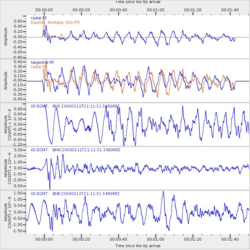
DGMT Dagmar, Montana, USA - Earthquake Result Viewer
*The percent match for this event was below the threshold and hence no stack was calculated.
| Earthquake location: |
Costa Rica |
| Earthquake latitude/longitude: |
8.5/-83.2 |
| Earthquake time(UTC): |
2009/03/11 (070) 21:03:58 GMT |
| Earthquake Depth: |
17 km |
| Earthquake Magnitude: |
5.7 MB, 5.6 MS, 5.9 MW, 5.8 MW |
| Earthquake Catalog/Contributor: |
WHDF/NEIC |
|
| Network: |
US United States National Seismic Network |
| Station: |
DGMT Dagmar, Montana, USA |
| Lat/Lon: |
48.47 N/104.20 W |
| Elevation: |
0.0 m |
|
| Distance: |
43.6 deg |
| Az: |
339.779 deg |
| Baz: |
149.086 deg |
| Ray Param: |
$rayparam |
*The percent match for this event was below the threshold and hence was not used in the summary stack. |
|
| Radial Match: |
59.4287 % |
| Radial Bump: |
400 |
| Transverse Match: |
55.133156 % |
| Transverse Bump: |
400 |
| SOD ConfigId: |
2658 |
| Insert Time: |
2010-03-05 01:31:04.388 +0000 |
| GWidth: |
2.5 |
| Max Bumps: |
400 |
| Tol: |
0.001 |
|
Signal To Noise
| Channel | StoN | STA | LTA |
| US:DGMT: :BHN:20090311T21:11:31.348988Z | 9.141355 | 1.2341792E-6 | 1.3501054E-7 |
| US:DGMT: :BHE:20090311T21:11:31.348988Z | 1.9631841 | 7.6988965E-7 | 3.9216377E-7 |
| US:DGMT: :BHZ:20090311T21:11:31.348988Z | 1.3176236 | 7.113767E-7 | 5.398937E-7 |
| Arrivals |
| Ps | |
| PpPs | |
| PsPs/PpSs | |


