You are here: Home > Network List > US - United States National Seismic Network Stations List
> Station DGMT Dagmar, Montana, USA > Earthquake Result Viewer
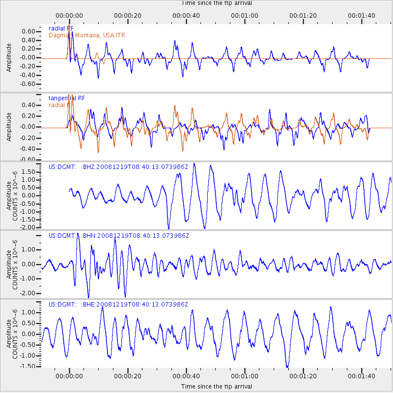
DGMT Dagmar, Montana, USA - Earthquake Result Viewer
*The percent match for this event was below the threshold and hence no stack was calculated.
| Earthquake location: |
Northern Mid-Atlantic Ridge |
| Earthquake latitude/longitude: |
47.0/-27.3 |
| Earthquake time(UTC): |
2008/12/19 (354) 08:31:51 GMT |
| Earthquake Depth: |
2.0 km |
| Earthquake Magnitude: |
5.8 MB, 5.6 MS, 5.9 MW, 5.8 MW |
| Earthquake Catalog/Contributor: |
WHDF/NEIC |
|
| Network: |
US United States National Seismic Network |
| Station: |
DGMT Dagmar, Montana, USA |
| Lat/Lon: |
48.47 N/104.20 W |
| Elevation: |
0.0 m |
|
| Distance: |
49.7 deg |
| Az: |
301.738 deg |
| Baz: |
61.004 deg |
| Ray Param: |
$rayparam |
*The percent match for this event was below the threshold and hence was not used in the summary stack. |
|
| Radial Match: |
74.056694 % |
| Radial Bump: |
400 |
| Transverse Match: |
74.08718 % |
| Transverse Bump: |
326 |
| SOD ConfigId: |
2658 |
| Insert Time: |
2010-03-05 01:31:08.202 +0000 |
| GWidth: |
2.5 |
| Max Bumps: |
400 |
| Tol: |
0.001 |
|
Signal To Noise
| Channel | StoN | STA | LTA |
| US:DGMT: :BHN:20081219T08:40:13.073986Z | 4.5452404 | 9.375602E-7 | 2.0627296E-7 |
| US:DGMT: :BHE:20081219T08:40:13.073986Z | 1.1397678 | 5.028686E-7 | 4.412027E-7 |
| US:DGMT: :BHZ:20081219T08:40:13.073986Z | 2.6470168 | 8.415277E-7 | 3.1791552E-7 |
| Arrivals |
| Ps | |
| PpPs | |
| PsPs/PpSs | |


