You are here: Home > Network List > US - United States National Seismic Network Stations List
> Station DGMT Dagmar, Montana, USA > Earthquake Result Viewer
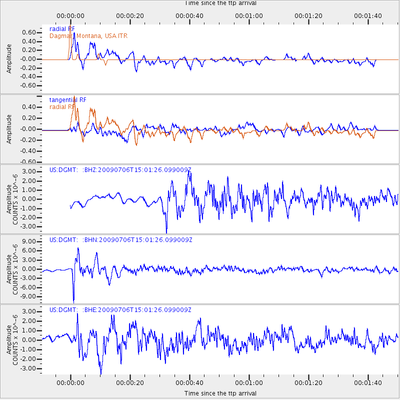
DGMT Dagmar, Montana, USA - Earthquake Result Viewer
*The percent match for this event was below the threshold and hence no stack was calculated.
| Earthquake location: |
Rat Islands, Aleutian Islands |
| Earthquake latitude/longitude: |
50.4/177.0 |
| Earthquake time(UTC): |
2009/07/06 (187) 14:53:12 GMT |
| Earthquake Depth: |
22 km |
| Earthquake Magnitude: |
6.0 MB, 5.8 MS, 6.1 MW, 6.0 MW |
| Earthquake Catalog/Contributor: |
WHDF/NEIC |
|
| Network: |
US United States National Seismic Network |
| Station: |
DGMT Dagmar, Montana, USA |
| Lat/Lon: |
48.47 N/104.20 W |
| Elevation: |
0.0 m |
|
| Distance: |
49.0 deg |
| Az: |
59.926 deg |
| Baz: |
303.741 deg |
| Ray Param: |
$rayparam |
*The percent match for this event was below the threshold and hence was not used in the summary stack. |
|
| Radial Match: |
89.04887 % |
| Radial Bump: |
400 |
| Transverse Match: |
82.95193 % |
| Transverse Bump: |
400 |
| SOD ConfigId: |
2648 |
| Insert Time: |
2010-03-05 01:31:14.863 +0000 |
| GWidth: |
2.5 |
| Max Bumps: |
400 |
| Tol: |
0.001 |
|
Signal To Noise
| Channel | StoN | STA | LTA |
| US:DGMT: :BHN:20090706T15:01:26.099009Z | 13.585725 | 3.5515166E-6 | 2.6141532E-7 |
| US:DGMT: :BHE:20090706T15:01:26.099009Z | 4.1322784 | 1.0696684E-6 | 2.588568E-7 |
| US:DGMT: :BHZ:20090706T15:01:26.099009Z | 3.4742873 | 1.3367152E-6 | 3.8474516E-7 |
| Arrivals |
| Ps | |
| PpPs | |
| PsPs/PpSs | |


