You are here: Home > Network List > US - United States National Seismic Network Stations List
> Station DGMT Dagmar, Montana, USA > Earthquake Result Viewer
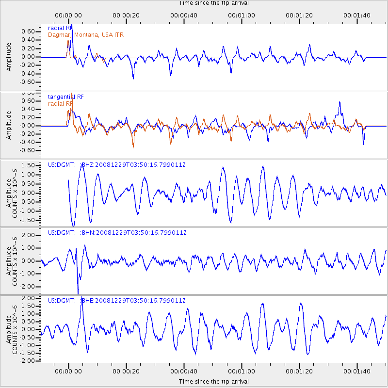
DGMT Dagmar, Montana, USA - Earthquake Result Viewer
*The percent match for this event was below the threshold and hence no stack was calculated.
| Earthquake location: |
Afghanistan-Tajikistan Bord Reg. |
| Earthquake latitude/longitude: |
36.4/71.1 |
| Earthquake time(UTC): |
2008/12/29 (364) 03:37:41 GMT |
| Earthquake Depth: |
158 km |
| Earthquake Magnitude: |
5.9 MB, 5.8 MW, 5.8 MW |
| Earthquake Catalog/Contributor: |
WHDF/NEIC |
|
| Network: |
US United States National Seismic Network |
| Station: |
DGMT Dagmar, Montana, USA |
| Lat/Lon: |
48.47 N/104.20 W |
| Elevation: |
0.0 m |
|
| Distance: |
95.4 deg |
| Az: |
356.84 deg |
| Baz: |
3.831 deg |
| Ray Param: |
$rayparam |
*The percent match for this event was below the threshold and hence was not used in the summary stack. |
|
| Radial Match: |
51.713062 % |
| Radial Bump: |
281 |
| Transverse Match: |
48.924404 % |
| Transverse Bump: |
366 |
| SOD ConfigId: |
2658 |
| Insert Time: |
2010-03-05 01:31:15.587 +0000 |
| GWidth: |
2.5 |
| Max Bumps: |
400 |
| Tol: |
0.001 |
|
Signal To Noise
| Channel | StoN | STA | LTA |
| US:DGMT: :BHN:20081229T03:50:16.799011Z | 3.5119317 | 9.1734563E-7 | 2.6120827E-7 |
| US:DGMT: :BHE:20081229T03:50:16.799011Z | 1.4432656 | 8.458271E-7 | 5.8605093E-7 |
| US:DGMT: :BHZ:20081229T03:50:16.799011Z | 0.25378817 | 2.0145194E-7 | 7.937798E-7 |
| Arrivals |
| Ps | |
| PpPs | |
| PsPs/PpSs | |


