You are here: Home > Network List > US - United States National Seismic Network Stations List
> Station DGMT Dagmar, Montana, USA > Earthquake Result Viewer
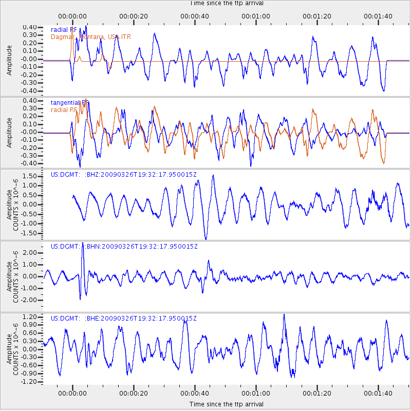
DGMT Dagmar, Montana, USA - Earthquake Result Viewer
*The percent match for this event was below the threshold and hence no stack was calculated.
| Earthquake location: |
Northwest Of Ryukyu Islands |
| Earthquake latitude/longitude: |
27.4/126.7 |
| Earthquake time(UTC): |
2009/03/26 (085) 19:19:59 GMT |
| Earthquake Depth: |
160 km |
| Earthquake Magnitude: |
5.6 MB, 5.9 MW, 5.9 MW |
| Earthquake Catalog/Contributor: |
WHDF/NEIC |
|
| Network: |
US United States National Seismic Network |
| Station: |
DGMT Dagmar, Montana, USA |
| Lat/Lon: |
48.47 N/104.20 W |
| Elevation: |
0.0 m |
|
| Distance: |
91.8 deg |
| Az: |
31.111 deg |
| Baz: |
316.356 deg |
| Ray Param: |
$rayparam |
*The percent match for this event was below the threshold and hence was not used in the summary stack. |
|
| Radial Match: |
61.35562 % |
| Radial Bump: |
400 |
| Transverse Match: |
59.611816 % |
| Transverse Bump: |
400 |
| SOD ConfigId: |
2658 |
| Insert Time: |
2010-03-05 01:31:17.600 +0000 |
| GWidth: |
2.5 |
| Max Bumps: |
400 |
| Tol: |
0.001 |
|
Signal To Noise
| Channel | StoN | STA | LTA |
| US:DGMT: :BHN:20090326T19:32:17.950015Z | 4.199334 | 1.1142245E-6 | 2.6533357E-7 |
| US:DGMT: :BHE:20090326T19:32:17.950015Z | 0.5642411 | 3.126475E-7 | 5.5410266E-7 |
| US:DGMT: :BHZ:20090326T19:32:17.950015Z | 1.744199 | 6.7045215E-7 | 3.843897E-7 |
| Arrivals |
| Ps | |
| PpPs | |
| PsPs/PpSs | |


