You are here: Home > Network List > US - United States National Seismic Network Stations List
> Station DGMT Dagmar, Montana, USA > Earthquake Result Viewer
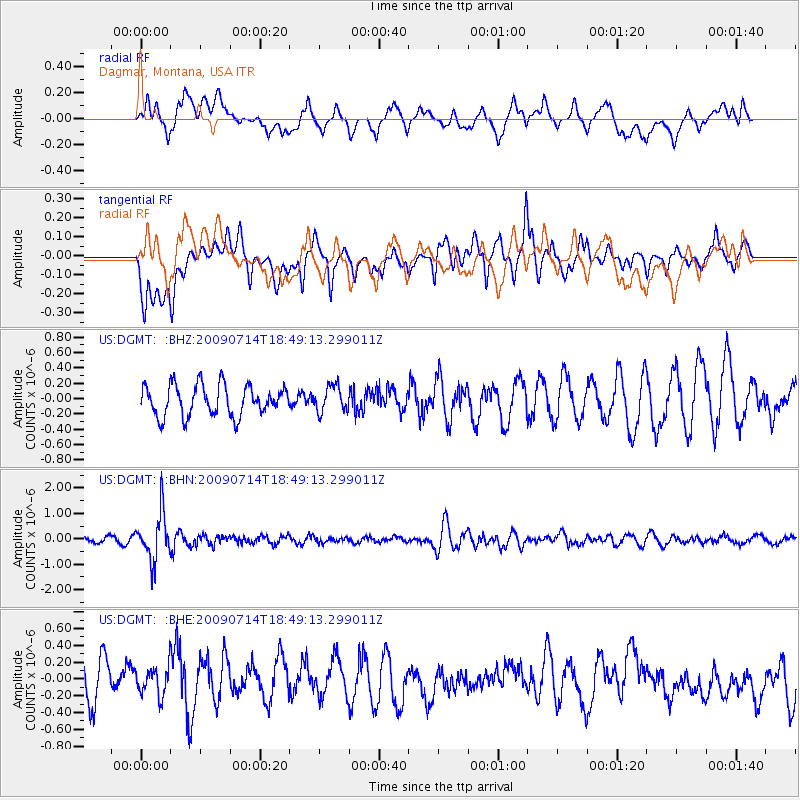
DGMT Dagmar, Montana, USA - Earthquake Result Viewer
*The percent match for this event was below the threshold and hence no stack was calculated.
| Earthquake location: |
Chile-Bolivia Border Region |
| Earthquake latitude/longitude: |
-21.8/-67.1 |
| Earthquake time(UTC): |
2009/07/14 (195) 18:38:08 GMT |
| Earthquake Depth: |
176 km |
| Earthquake Magnitude: |
5.7 MW, 5.4 MB, 5.7 MW |
| Earthquake Catalog/Contributor: |
WHDF/NEIC |
|
| Network: |
US United States National Seismic Network |
| Station: |
DGMT Dagmar, Montana, USA |
| Lat/Lon: |
48.47 N/104.20 W |
| Elevation: |
0.0 m |
|
| Distance: |
77.4 deg |
| Az: |
335.711 deg |
| Baz: |
144.947 deg |
| Ray Param: |
$rayparam |
*The percent match for this event was below the threshold and hence was not used in the summary stack. |
|
| Radial Match: |
58.894855 % |
| Radial Bump: |
400 |
| Transverse Match: |
70.631454 % |
| Transverse Bump: |
400 |
| SOD ConfigId: |
2648 |
| Insert Time: |
2010-03-05 01:31:22.478 +0000 |
| GWidth: |
2.5 |
| Max Bumps: |
400 |
| Tol: |
0.001 |
|
Signal To Noise
| Channel | StoN | STA | LTA |
| US:DGMT: :BHN:20090714T18:49:13.299011Z | 6.5361624 | 9.2886387E-7 | 1.421115E-7 |
| US:DGMT: :BHE:20090714T18:49:13.299011Z | 0.7744855 | 1.6716335E-7 | 2.1583793E-7 |
| US:DGMT: :BHZ:20090714T18:49:13.299011Z | 0.84005284 | 1.6734595E-7 | 1.9920884E-7 |
| Arrivals |
| Ps | |
| PpPs | |
| PsPs/PpSs | |


