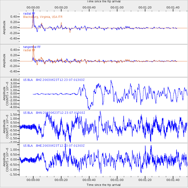
BLA Blacksburg, Virginia, USA - Earthquake Result Viewer
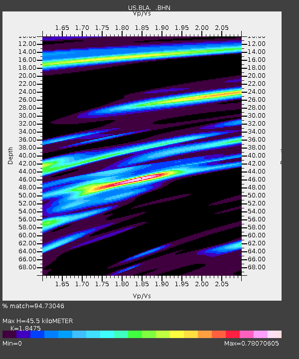
Earthquake location: Rat Islands, Aleutian Islands
Earthquake latitude/longitude: 51.4/176.8
Earthquake time(UTC): 2003/06/23 (174) 12:12:34 GMT
Earthquake Depth: 20 km
Earthquake Magnitude: 6.3 MB, 7.0 MS, 6.9 MW, 6.8 MW
Earthquake Catalog/Contributor: WHDF/NEIC
Network: US United States National Seismic Network
Station: BLA Blacksburg, Virginia, USA
Lat/Lon: 37.21 N/80.42 W
Elevation: 634 m
Distance: 69.0 deg
Az: 56.525 deg
Baz: 319.16 deg
Ray Param: 0.055939835
Estimated Moho Depth: 45.5 km
Estimated Crust Vp/Vs: 1.85
Assumed Crust Vp: 6.159 km/s
Estimated Crust Vs: 3.334 km/s
Estimated Crust Poisson's Ratio: 0.29
Radial Match: 94.73046 %
Radial Bump: 391
Transverse Match: 86.7176 %
Transverse Bump: 400
SOD ConfigId: 110177
Insert Time: 2010-03-05 01:32:43.666 +0000
GWidth: 2.5
Max Bumps: 400
Tol: 0.001

Signal To Noise

ChannelStoNSTALTA
US:BLA: :BHN:20030623T12:23:07.01303Z1.7432823.6815794E-72.1118669E-7
US:BLA: :BHE:20030623T12:23:07.01303Z1.5160622.4470137E-71.6140591E-7
US:BLA: :BHZ:20030623T12:23:07.01303Z8.8166447.787626E-78.83287E-8
Arrivals
Ps6.5 SECOND
PpPs20 SECOND
PsPs/PpSs27 SECOND