You are here: Home > Network List > TA - USArray Transportable Network (new EarthScope stations) Stations List
> Station A21K Barrow, AK, USA > Earthquake Result Viewer
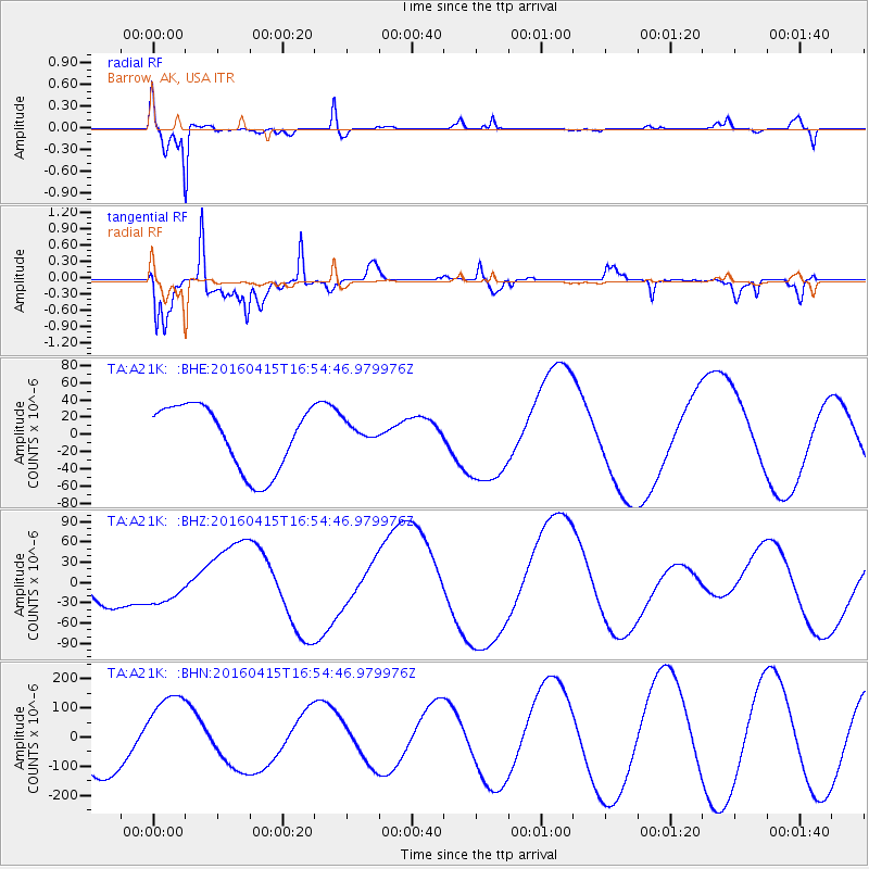
A21K Barrow, AK, USA - Earthquake Result Viewer
*The percent match for this event was below the threshold and hence no stack was calculated.
| Earthquake location: |
Kyushu, Japan |
| Earthquake latitude/longitude: |
32.9/130.8 |
| Earthquake time(UTC): |
2016/04/15 (106) 16:45:56 GMT |
| Earthquake Depth: |
10 km |
| Earthquake Magnitude: |
5.7 MB |
| Earthquake Catalog/Contributor: |
NEIC PDE/NEIC COMCAT |
|
| Network: |
TA USArray Transportable Network (new EarthScope stations) |
| Station: |
A21K Barrow, AK, USA |
| Lat/Lon: |
71.32 N/156.62 W |
| Elevation: |
577 m |
|
| Distance: |
53.6 deg |
| Az: |
22.435 deg |
| Baz: |
265.372 deg |
| Ray Param: |
$rayparam |
*The percent match for this event was below the threshold and hence was not used in the summary stack. |
|
| Radial Match: |
90.61728 % |
| Radial Bump: |
400 |
| Transverse Match: |
47.108883 % |
| Transverse Bump: |
400 |
| SOD ConfigId: |
7422571 |
| Insert Time: |
2019-04-22 07:25:44.510 +0000 |
| GWidth: |
2.5 |
| Max Bumps: |
400 |
| Tol: |
0.001 |
|
Signal To Noise
| Channel | StoN | STA | LTA |
| TA:A21K: :BHZ:20160415T16:54:46.979976Z | 1.0034186 | 2.6314048E-5 | 2.6224398E-5 |
| TA:A21K: :BHN:20160415T16:54:46.979976Z | 1.6482244 | 1.4232662E-4 | 8.635149E-5 |
| TA:A21K: :BHE:20160415T16:54:46.979976Z | 0.28837505 | 1.0835206E-5 | 3.7573314E-5 |
| Arrivals |
| Ps | |
| PpPs | |
| PsPs/PpSs | |


