You are here: Home > Network List > UW - Pacific Northwest Regional Seismic Network Stations List
> Station LEBA Lebam, WA, USA > Earthquake Result Viewer
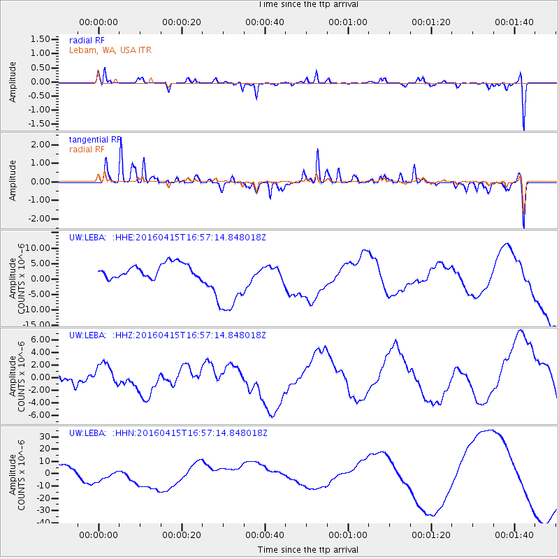
LEBA Lebam, WA, USA - Earthquake Result Viewer
*The percent match for this event was below the threshold and hence no stack was calculated.
| Earthquake location: |
Kyushu, Japan |
| Earthquake latitude/longitude: |
32.9/130.8 |
| Earthquake time(UTC): |
2016/04/15 (106) 16:45:56 GMT |
| Earthquake Depth: |
10 km |
| Earthquake Magnitude: |
5.7 MB |
| Earthquake Catalog/Contributor: |
NEIC PDE/NEIC COMCAT |
|
| Network: |
UW Pacific Northwest Regional Seismic Network |
| Station: |
LEBA Lebam, WA, USA |
| Lat/Lon: |
46.55 N/123.56 W |
| Elevation: |
73 m |
|
| Distance: |
76.4 deg |
| Az: |
43.153 deg |
| Baz: |
303.506 deg |
| Ray Param: |
$rayparam |
*The percent match for this event was below the threshold and hence was not used in the summary stack. |
|
| Radial Match: |
42.85083 % |
| Radial Bump: |
291 |
| Transverse Match: |
53.75064 % |
| Transverse Bump: |
260 |
| SOD ConfigId: |
7422571 |
| Insert Time: |
2019-04-22 07:26:46.170 +0000 |
| GWidth: |
2.5 |
| Max Bumps: |
400 |
| Tol: |
0.001 |
|
Signal To Noise
| Channel | StoN | STA | LTA |
| UW:LEBA: :HHZ:20160415T16:57:14.848018Z | 0.8013181 | 1.8573157E-6 | 2.3178256E-6 |
| UW:LEBA: :HHN:20160415T16:57:14.848018Z | 1.9769249 | 6.970712E-6 | 3.526038E-6 |
| UW:LEBA: :HHE:20160415T16:57:14.848018Z | 5.0160346 | 1.1000509E-5 | 2.193069E-6 |
| Arrivals |
| Ps | |
| PpPs | |
| PsPs/PpSs | |


