You are here: Home > Network List > US - United States National Seismic Network Stations List
> Station BLA Blacksburg, Virginia, USA > Earthquake Result Viewer
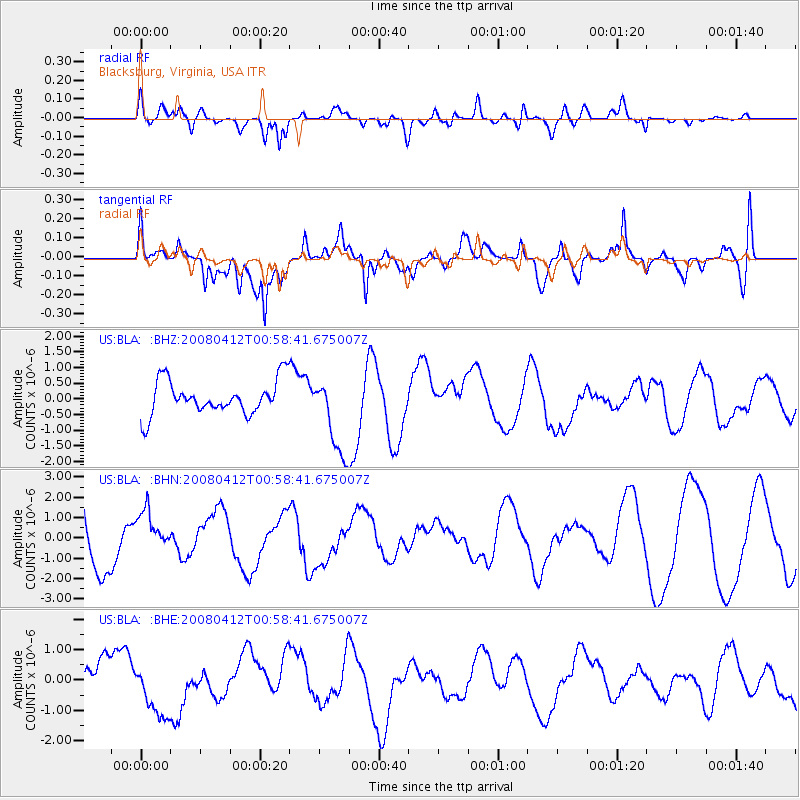
BLA Blacksburg, Virginia, USA - Earthquake Result Viewer
*The percent match for this event was below the threshold and hence no stack was calculated.
| Earthquake location: |
Kuril Islands |
| Earthquake latitude/longitude: |
43.9/147.5 |
| Earthquake time(UTC): |
2008/04/12 (103) 00:46:28 GMT |
| Earthquake Depth: |
64 km |
| Earthquake Magnitude: |
5.7 MB |
| Earthquake Catalog/Contributor: |
WHDF/NEIC |
|
| Network: |
US United States National Seismic Network |
| Station: |
BLA Blacksburg, Virginia, USA |
| Lat/Lon: |
37.21 N/80.42 W |
| Elevation: |
634 m |
|
| Distance: |
88.3 deg |
| Az: |
36.357 deg |
| Baz: |
327.523 deg |
| Ray Param: |
$rayparam |
*The percent match for this event was below the threshold and hence was not used in the summary stack. |
|
| Radial Match: |
51.107243 % |
| Radial Bump: |
400 |
| Transverse Match: |
51.450165 % |
| Transverse Bump: |
400 |
| SOD ConfigId: |
2504 |
| Insert Time: |
2010-03-05 01:36:09.544 +0000 |
| GWidth: |
2.5 |
| Max Bumps: |
400 |
| Tol: |
0.001 |
|
Signal To Noise
| Channel | StoN | STA | LTA |
| US:BLA: :BHN:20080412T00:58:41.675007Z | 0.83350384 | 1.058315E-6 | 1.2697183E-6 |
| US:BLA: :BHE:20080412T00:58:41.675007Z | 1.8056227 | 9.133809E-7 | 5.058537E-7 |
| US:BLA: :BHZ:20080412T00:58:41.675007Z | 2.3665519 | 1.2885314E-6 | 5.444763E-7 |
| Arrivals |
| Ps | |
| PpPs | |
| PsPs/PpSs | |


