You are here: Home > Network List > US - United States National Seismic Network Stations List
> Station DGMT Dagmar, Montana, USA > Earthquake Result Viewer
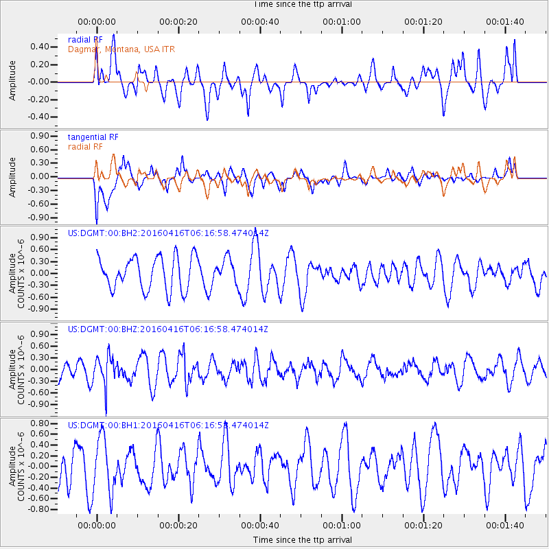
DGMT Dagmar, Montana, USA - Earthquake Result Viewer
*The percent match for this event was below the threshold and hence no stack was calculated.
| Earthquake location: |
Northern Chile |
| Earthquake latitude/longitude: |
-26.5/-69.9 |
| Earthquake time(UTC): |
2016/04/16 (107) 06:05:22 GMT |
| Earthquake Depth: |
59 km |
| Earthquake Magnitude: |
5.3 Mww |
| Earthquake Catalog/Contributor: |
NEIC PDE/us |
|
| Network: |
US United States National Seismic Network |
| Station: |
DGMT Dagmar, Montana, USA |
| Lat/Lon: |
48.47 N/104.20 W |
| Elevation: |
0.0 m |
|
| Distance: |
80.7 deg |
| Az: |
337.643 deg |
| Baz: |
149.179 deg |
| Ray Param: |
$rayparam |
*The percent match for this event was below the threshold and hence was not used in the summary stack. |
|
| Radial Match: |
51.562115 % |
| Radial Bump: |
400 |
| Transverse Match: |
71.5075 % |
| Transverse Bump: |
400 |
| SOD ConfigId: |
7422571 |
| Insert Time: |
2019-04-22 07:43:48.157 +0000 |
| GWidth: |
2.5 |
| Max Bumps: |
400 |
| Tol: |
0.001 |
|
Signal To Noise
| Channel | StoN | STA | LTA |
| US:DGMT:00:BHZ:20160416T06:16:58.474014Z | 1.8481518 | 3.716995E-7 | 2.0111958E-7 |
| US:DGMT:00:BH1:20160416T06:16:58.474014Z | 1.3737395 | 5.078471E-7 | 3.6968228E-7 |
| US:DGMT:00:BH2:20160416T06:16:58.474014Z | 0.7729346 | 3.1833883E-7 | 4.118574E-7 |
| Arrivals |
| Ps | |
| PpPs | |
| PsPs/PpSs | |


