You are here: Home > Network List > UW - Pacific Northwest Regional Seismic Network Stations List
> Station MRBL Marblemount, WA, USA > Earthquake Result Viewer
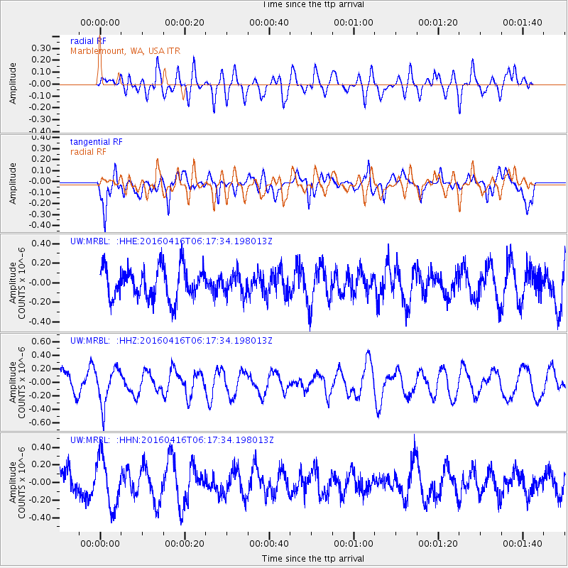
MRBL Marblemount, WA, USA - Earthquake Result Viewer
*The percent match for this event was below the threshold and hence no stack was calculated.
| Earthquake location: |
Northern Chile |
| Earthquake latitude/longitude: |
-26.5/-69.9 |
| Earthquake time(UTC): |
2016/04/16 (107) 06:05:22 GMT |
| Earthquake Depth: |
59 km |
| Earthquake Magnitude: |
5.3 Mww |
| Earthquake Catalog/Contributor: |
NEIC PDE/us |
|
| Network: |
UW Pacific Northwest Regional Seismic Network |
| Station: |
MRBL Marblemount, WA, USA |
| Lat/Lon: |
48.52 N/121.48 W |
| Elevation: |
75 m |
|
| Distance: |
87.8 deg |
| Az: |
328.558 deg |
| Baz: |
135.308 deg |
| Ray Param: |
$rayparam |
*The percent match for this event was below the threshold and hence was not used in the summary stack. |
|
| Radial Match: |
52.757454 % |
| Radial Bump: |
400 |
| Transverse Match: |
65.540474 % |
| Transverse Bump: |
400 |
| SOD ConfigId: |
7422571 |
| Insert Time: |
2019-04-22 07:44:11.124 +0000 |
| GWidth: |
2.5 |
| Max Bumps: |
400 |
| Tol: |
0.001 |
|
Signal To Noise
| Channel | StoN | STA | LTA |
| UW:MRBL: :HHZ:20160416T06:17:34.198013Z | 1.6040676 | 2.6509062E-7 | 1.652615E-7 |
| UW:MRBL: :HHN:20160416T06:17:34.198013Z | 2.0995667 | 2.8695405E-7 | 1.3667298E-7 |
| UW:MRBL: :HHE:20160416T06:17:34.198013Z | 0.6664223 | 1.056222E-7 | 1.5849139E-7 |
| Arrivals |
| Ps | |
| PpPs | |
| PsPs/PpSs | |


