You are here: Home > Network List > US - United States National Seismic Network Stations List
> Station BLA Blacksburg, Virginia, USA > Earthquake Result Viewer
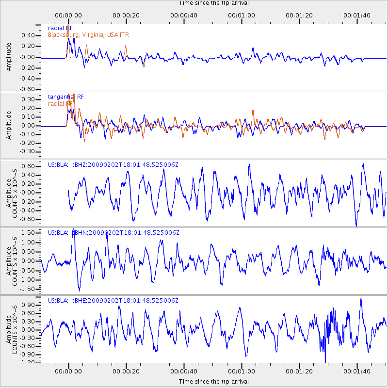
BLA Blacksburg, Virginia, USA - Earthquake Result Viewer
*The percent match for this event was below the threshold and hence no stack was calculated.
| Earthquake location: |
Near Coast Of Peru |
| Earthquake latitude/longitude: |
-13.6/-76.6 |
| Earthquake time(UTC): |
2009/02/02 (033) 17:53:21 GMT |
| Earthquake Depth: |
21 km |
| Earthquake Magnitude: |
5.6 MB, 5.6 MS, 6.0 MW, 5.9 MW |
| Earthquake Catalog/Contributor: |
WHDF/NEIC |
|
| Network: |
US United States National Seismic Network |
| Station: |
BLA Blacksburg, Virginia, USA |
| Lat/Lon: |
37.21 N/80.42 W |
| Elevation: |
634 m |
|
| Distance: |
50.7 deg |
| Az: |
356.012 deg |
| Baz: |
175.14 deg |
| Ray Param: |
$rayparam |
*The percent match for this event was below the threshold and hence was not used in the summary stack. |
|
| Radial Match: |
56.32699 % |
| Radial Bump: |
400 |
| Transverse Match: |
65.585785 % |
| Transverse Bump: |
400 |
| SOD ConfigId: |
6627 |
| Insert Time: |
2010-03-05 01:36:17.672 +0000 |
| GWidth: |
2.5 |
| Max Bumps: |
400 |
| Tol: |
0.001 |
|
Signal To Noise
| Channel | StoN | STA | LTA |
| US:BLA: :BHN:20090202T18:01:48.525006Z | 3.6728582 | 9.0985606E-7 | 2.4772424E-7 |
| US:BLA: :BHE:20090202T18:01:48.525006Z | 0.88724184 | 1.9217178E-7 | 2.1659459E-7 |
| US:BLA: :BHZ:20090202T18:01:48.525006Z | 1.2116208 | 3.1454508E-7 | 2.5960685E-7 |
| Arrivals |
| Ps | |
| PpPs | |
| PsPs/PpSs | |


