You are here: Home > Network List > US - United States National Seismic Network Stations List
> Station BLA Blacksburg, Virginia, USA > Earthquake Result Viewer
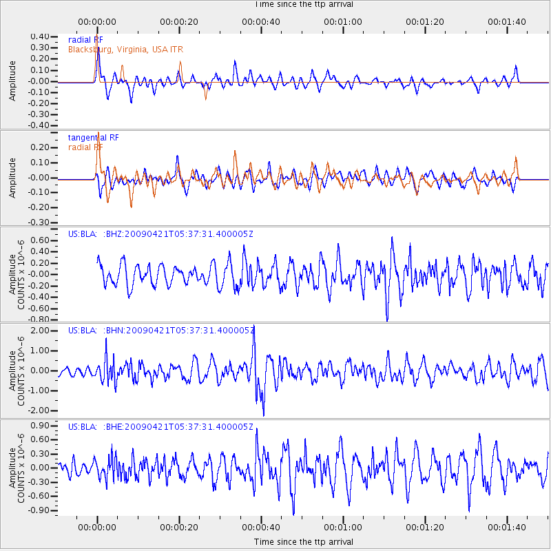
BLA Blacksburg, Virginia, USA - Earthquake Result Viewer
*The percent match for this event was below the threshold and hence no stack was calculated.
| Earthquake location: |
Kuril Islands |
| Earthquake latitude/longitude: |
50.8/155.0 |
| Earthquake time(UTC): |
2009/04/21 (111) 05:26:11 GMT |
| Earthquake Depth: |
152 km |
| Earthquake Magnitude: |
6.0 MB, 6.2 MW, 6.2 MW |
| Earthquake Catalog/Contributor: |
WHDF/NEIC |
|
| Network: |
US United States National Seismic Network |
| Station: |
BLA Blacksburg, Virginia, USA |
| Lat/Lon: |
37.21 N/80.42 W |
| Elevation: |
634 m |
|
| Distance: |
79.7 deg |
| Az: |
41.921 deg |
| Baz: |
327.949 deg |
| Ray Param: |
$rayparam |
*The percent match for this event was below the threshold and hence was not used in the summary stack. |
|
| Radial Match: |
63.7733 % |
| Radial Bump: |
400 |
| Transverse Match: |
59.57362 % |
| Transverse Bump: |
400 |
| SOD ConfigId: |
2760 |
| Insert Time: |
2010-03-05 01:36:19.687 +0000 |
| GWidth: |
2.5 |
| Max Bumps: |
400 |
| Tol: |
0.001 |
|
Signal To Noise
| Channel | StoN | STA | LTA |
| US:BLA: :BHN:20090421T05:37:31.400005Z | 2.0350585 | 5.5951364E-7 | 2.7493735E-7 |
| US:BLA: :BHE:20090421T05:37:31.400005Z | 1.0481367 | 2.0861009E-7 | 1.9902946E-7 |
| US:BLA: :BHZ:20090421T05:37:31.400005Z | 1.4031104 | 2.3044797E-7 | 1.6424079E-7 |
| Arrivals |
| Ps | |
| PpPs | |
| PsPs/PpSs | |


