You are here: Home > Network List > TA - USArray Transportable Network (new EarthScope stations) Stations List
> Station X43A Marvell, AR, USA > Earthquake Result Viewer
X43A Marvell, AR, USA - Earthquake Result Viewer
*The percent match for this event was below the threshold and hence no stack was calculated.
| Earthquake location: |
Easter Island Region |
| Earthquake latitude/longitude: |
-29.6/-111.6 |
| Earthquake time(UTC): |
2016/04/16 (107) 07:34:20 GMT |
| Earthquake Depth: |
10 km |
| Earthquake Magnitude: |
5.5 MWC, 5.5 MWC |
| Earthquake Catalog/Contributor: |
NEIC PDE/NEIC COMCAT |
|
| Network: |
TA USArray Transportable Network (new EarthScope stations) |
| Station: |
X43A Marvell, AR, USA |
| Lat/Lon: |
34.52 N/90.88 W |
| Elevation: |
53 m |
|
| Distance: |
66.7 deg |
| Az: |
18.526 deg |
| Baz: |
199.585 deg |
| Ray Param: |
$rayparam |
*The percent match for this event was below the threshold and hence was not used in the summary stack. |
|
| Radial Match: |
99.82488 % |
| Radial Bump: |
78 |
| Transverse Match: |
98.83067 % |
| Transverse Bump: |
400 |
| SOD ConfigId: |
7422571 |
| Insert Time: |
2019-04-22 07:53:00.569 +0000 |
| GWidth: |
2.5 |
| Max Bumps: |
400 |
| Tol: |
0.001 |
|
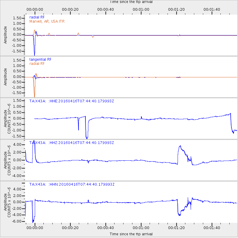
Signal To Noise
| Channel | StoN | STA | LTA |
| TA:X43A: :HHZ:20160416T07:44:40.179993Z | 8.292556 | 2.2489508E-6 | 2.7120117E-7 |
| TA:X43A: :HHN:20160416T07:44:40.179993Z | 5.9596124 | 2.4657397E-6 | 4.1374165E-7 |
| TA:X43A: :HHE:20160416T07:44:40.179993Z | 7.7052393 | 7.5330684E-7 | 9.7765536E-8 |
| Arrivals |
| Ps | |
| PpPs | |
| PsPs/PpSs | |


