You are here: Home > Network List > US - United States National Seismic Network Stations List
> Station BLA Blacksburg, Virginia, USA > Earthquake Result Viewer
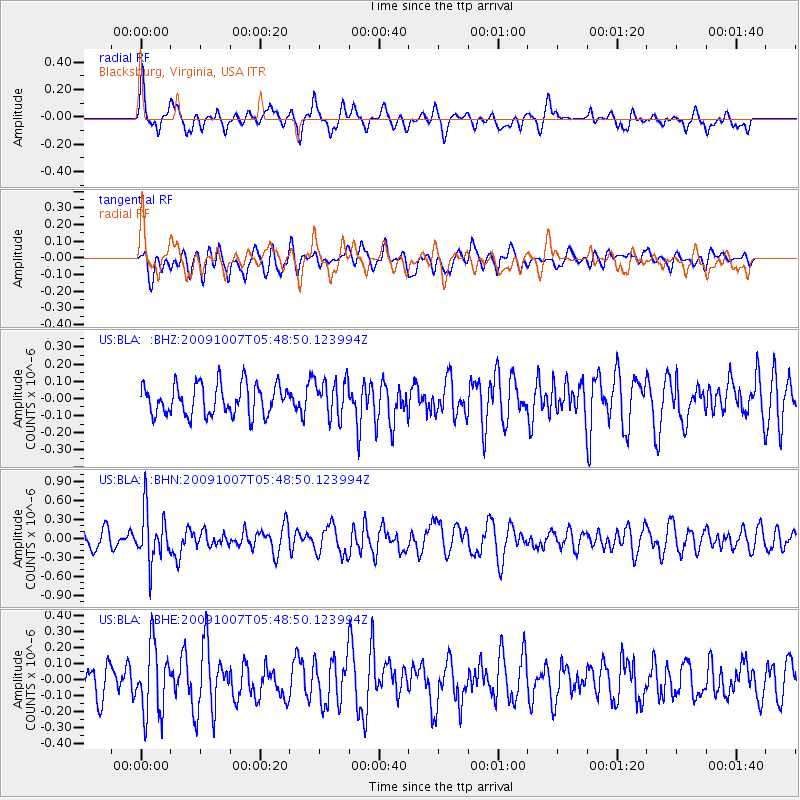
BLA Blacksburg, Virginia, USA - Earthquake Result Viewer
*The percent match for this event was below the threshold and hence no stack was calculated.
| Earthquake location: |
Rat Islands, Aleutian Islands |
| Earthquake latitude/longitude: |
52.2/178.1 |
| Earthquake time(UTC): |
2009/10/07 (280) 05:38:37 GMT |
| Earthquake Depth: |
138 km |
| Earthquake Magnitude: |
5.6 MB, 5.6 MW, 5.6 MW |
| Earthquake Catalog/Contributor: |
WHDF/NEIC |
|
| Network: |
US United States National Seismic Network |
| Station: |
BLA Blacksburg, Virginia, USA |
| Lat/Lon: |
37.21 N/80.42 W |
| Elevation: |
634 m |
|
| Distance: |
67.9 deg |
| Az: |
57.589 deg |
| Baz: |
319.348 deg |
| Ray Param: |
$rayparam |
*The percent match for this event was below the threshold and hence was not used in the summary stack. |
|
| Radial Match: |
67.74371 % |
| Radial Bump: |
400 |
| Transverse Match: |
51.37216 % |
| Transverse Bump: |
400 |
| SOD ConfigId: |
2622 |
| Insert Time: |
2010-03-05 01:36:44.992 +0000 |
| GWidth: |
2.5 |
| Max Bumps: |
400 |
| Tol: |
0.001 |
|
Signal To Noise
| Channel | StoN | STA | LTA |
| US:BLA: :BHN:20091007T05:48:50.123994Z | 2.151133 | 3.9874337E-7 | 1.8536434E-7 |
| US:BLA: :BHE:20091007T05:48:50.123994Z | 1.8346534 | 2.1491408E-7 | 1.17141525E-7 |
| US:BLA: :BHZ:20091007T05:48:50.123994Z | 1.2163339 | 1.0837149E-7 | 8.909683E-8 |
| Arrivals |
| Ps | |
| PpPs | |
| PsPs/PpSs | |


