You are here: Home > Network List > IU - Global Seismograph Network (GSN - IRIS/USGS) Stations List
> Station PMG Port Moresby, New Guinea > Earthquake Result Viewer
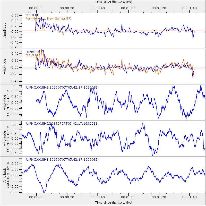
PMG Port Moresby, New Guinea - Earthquake Result Viewer
*The percent match for this event was below the threshold and hence no stack was calculated.
| Earthquake location: |
East Of North Island, N.Z. |
| Earthquake latitude/longitude: |
-35.4/-179.6 |
| Earthquake time(UTC): |
2015/07/07 (188) 05:35:14 GMT |
| Earthquake Depth: |
10 km |
| Earthquake Magnitude: |
5.6 MWW, 5.7 MWC |
| Earthquake Catalog/Contributor: |
NEIC PDE/NEIC COMCAT |
|
| Network: |
IU Global Seismograph Network (GSN - IRIS/USGS) |
| Station: |
PMG Port Moresby, New Guinea |
| Lat/Lon: |
9.40 S/147.16 E |
| Elevation: |
90 m |
|
| Distance: |
39.8 deg |
| Az: |
302.451 deg |
| Baz: |
135.698 deg |
| Ray Param: |
$rayparam |
*The percent match for this event was below the threshold and hence was not used in the summary stack. |
|
| Radial Match: |
64.06113 % |
| Radial Bump: |
400 |
| Transverse Match: |
39.43535 % |
| Transverse Bump: |
400 |
| SOD ConfigId: |
1085051 |
| Insert Time: |
2015-08-13 11:08:25.522 +0000 |
| GWidth: |
2.5 |
| Max Bumps: |
400 |
| Tol: |
0.001 |
|
Signal To Noise
| Channel | StoN | STA | LTA |
| IU:PMG:00:BHZ:20150707T05:42:17.169008Z | 3.3086808 | 1.0367139E-6 | 3.133315E-7 |
| IU:PMG:00:BH1:20150707T05:42:17.169008Z | 1.9083674 | 1.4583476E-6 | 7.641859E-7 |
| IU:PMG:00:BH2:20150707T05:42:17.169008Z | 1.0927029 | 6.789714E-7 | 6.213687E-7 |
| Arrivals |
| Ps | |
| PpPs | |
| PsPs/PpSs | |


