NEW Newport, Washington, USA - Earthquake Result Viewer
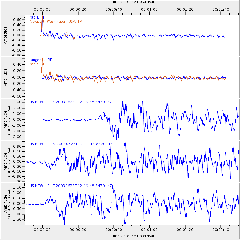
Earthquake location: Rat Islands, Aleutian Islands
Earthquake latitude/longitude: 51.4/176.8
Earthquake time(UTC): 2003/06/23 (174) 12:12:34 GMT
Earthquake Depth: 20 km
Earthquake Magnitude: 6.3 MB, 7.0 MS, 6.9 MW, 6.8 MW
Earthquake Catalog/Contributor: WHDF/NEIC
Network: US United States National Seismic Network
Station: NEW Newport, Washington, USA
Lat/Lon: 48.26 N/117.12 W
Elevation: 760 m
Distance: 41.4 deg
Az: 67.382 deg
Baz: 300.155 deg
Ray Param: 0.07376634
Estimated Moho Depth: 22.0 km
Estimated Crust Vp/Vs: 1.68
Assumed Crust Vp: 6.571 km/s
Estimated Crust Vs: 3.917 km/s
Estimated Crust Poisson's Ratio: 0.22
Radial Match: 94.76462 %
Radial Bump: 400
Transverse Match: 87.92859 %
Transverse Bump: 400
SOD ConfigId: 110177
Insert Time: 2010-03-05 01:39:41.569 +0000
GWidth: 2.5
Max Bumps: 400
Tol: 0.001

Signal To Noise

ChannelStoNSTALTA
US:NEW: :BHN:20030623T12:19:48.847014Z4.05663061.772658E-74.3697792E-8
US:NEW: :BHE:20030623T12:19:48.847014Z4.8004133.0777903E-76.411511E-8
US:NEW: :BHZ:20030623T12:19:48.847014Z6.15340665.617525E-79.129129E-8
Arrivals
Ps2.4 SECOND
PpPs8.3 SECOND
PsPs/PpSs11 SECOND