You are here: Home > Network List > TA - USArray Transportable Network (new EarthScope stations) Stations List
> Station 833A Chaparral WMA, Artesia Wells, TX, USA > Earthquake Result Viewer
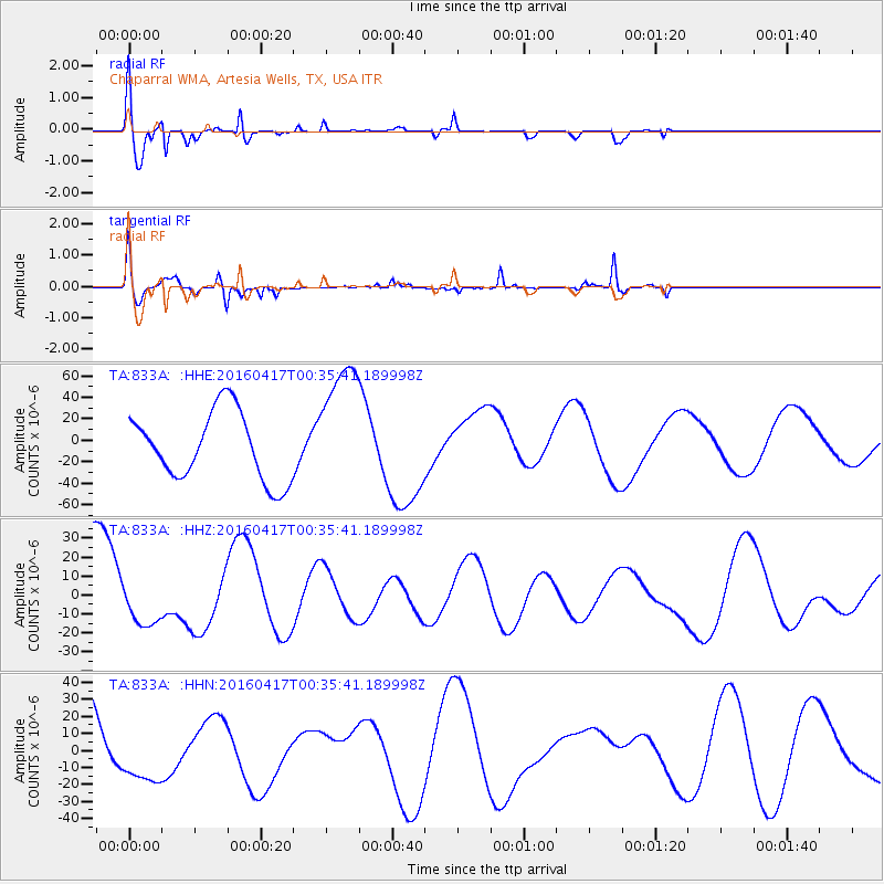
833A Chaparral WMA, Artesia Wells, TX, USA - Earthquake Result Viewer
*The percent match for this event was below the threshold and hence no stack was calculated.
| Earthquake location: |
Near Coast Of Ecuador |
| Earthquake latitude/longitude: |
-0.3/-80.5 |
| Earthquake time(UTC): |
2016/04/17 (108) 00:29:31 GMT |
| Earthquake Depth: |
16 km |
| Earthquake Magnitude: |
5.5 MB |
| Earthquake Catalog/Contributor: |
NEIC PDE/NEIC COMCAT |
|
| Network: |
TA USArray Transportable Network (new EarthScope stations) |
| Station: |
833A Chaparral WMA, Artesia Wells, TX, USA |
| Lat/Lon: |
28.32 N/99.39 W |
| Elevation: |
171 m |
|
| Distance: |
33.7 deg |
| Az: |
328.991 deg |
| Baz: |
144.243 deg |
| Ray Param: |
$rayparam |
*The percent match for this event was below the threshold and hence was not used in the summary stack. |
|
| Radial Match: |
75.55357 % |
| Radial Bump: |
400 |
| Transverse Match: |
85.23368 % |
| Transverse Bump: |
400 |
| SOD ConfigId: |
7422571 |
| Insert Time: |
2019-04-22 08:18:12.775 +0000 |
| GWidth: |
2.5 |
| Max Bumps: |
400 |
| Tol: |
0.001 |
|
Signal To Noise
| Channel | StoN | STA | LTA |
| TA:833A: :HHZ:20160417T00:35:41.189998Z | 0.60694516 | 1.1955008E-5 | 1.9697014E-5 |
| TA:833A: :HHN:20160417T00:35:41.189998Z | 0.6121294 | 1.8645927E-5 | 3.0460762E-5 |
| TA:833A: :HHE:20160417T00:35:41.189998Z | 1.9394969 | 6.106027E-5 | 3.1482534E-5 |
| Arrivals |
| Ps | |
| PpPs | |
| PsPs/PpSs | |


