You are here: Home > Network List > CN - Canadian National Seismograph Network Stations List
> Station INK INUVIK, NT > Earthquake Result Viewer
INK INUVIK, NT - Earthquake Result Viewer
*The percent match for this event was below the threshold and hence no stack was calculated.
| Earthquake location: |
Near Coast Of Ecuador |
| Earthquake latitude/longitude: |
-0.4/-80.3 |
| Earthquake time(UTC): |
2016/04/17 (108) 07:13:59 GMT |
| Earthquake Depth: |
10 km |
| Earthquake Magnitude: |
5.6 MB |
| Earthquake Catalog/Contributor: |
NEIC PDE/NEIC ALERT |
|
| Network: |
CN Canadian National Seismograph Network |
| Station: |
INK INUVIK, NT |
| Lat/Lon: |
68.31 N/133.53 W |
| Elevation: |
44 m |
|
| Distance: |
77.6 deg |
| Az: |
342.237 deg |
| Baz: |
124.858 deg |
| Ray Param: |
$rayparam |
*The percent match for this event was below the threshold and hence was not used in the summary stack. |
|
| Radial Match: |
69.23658 % |
| Radial Bump: |
400 |
| Transverse Match: |
59.61257 % |
| Transverse Bump: |
400 |
| SOD ConfigId: |
7422571 |
| Insert Time: |
2019-04-22 08:23:31.958 +0000 |
| GWidth: |
2.5 |
| Max Bumps: |
400 |
| Tol: |
0.001 |
|
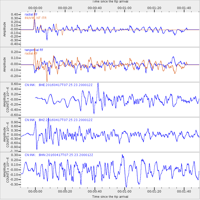
Signal To Noise
| Channel | StoN | STA | LTA |
| CN:INK: :BHZ:20160417T07:25:23.200012Z | 3.072907 | 4.833579E-7 | 1.5729664E-7 |
| CN:INK: :BHN:20160417T07:25:23.200012Z | 0.8234337 | 9.1190465E-8 | 1.10744146E-7 |
| CN:INK: :BHE:20160417T07:25:23.200012Z | 1.9896376 | 2.2358574E-7 | 1.1237511E-7 |
| Arrivals |
| Ps | |
| PpPs | |
| PsPs/PpSs | |


