You are here: Home > Network List > TA - USArray Transportable Network (new EarthScope stations) Stations List
> Station Z41A Richland Creek Farm, El Dorado, AR, USA > Earthquake Result Viewer
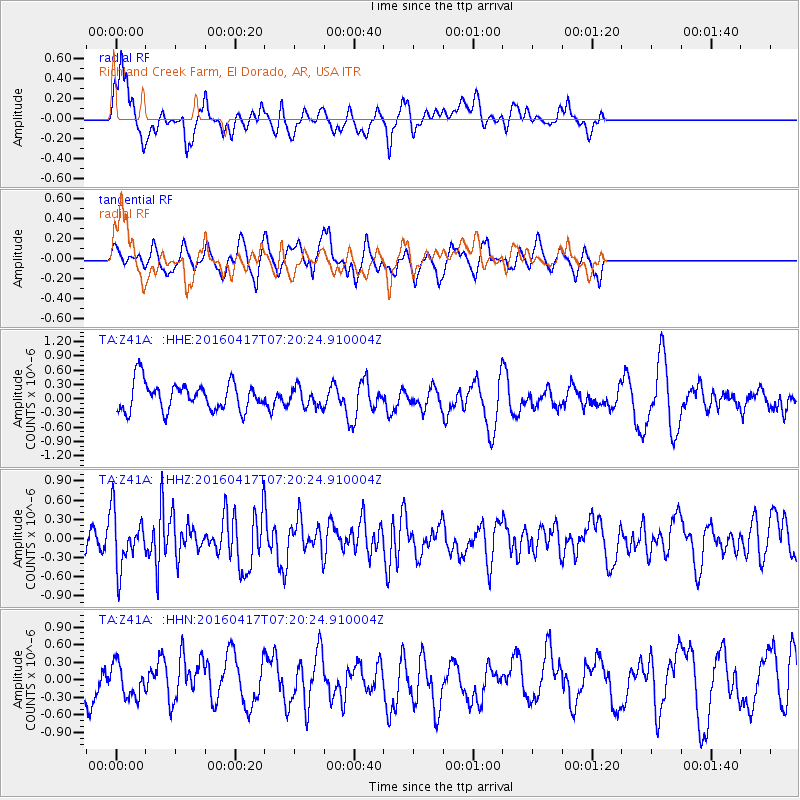
Z41A Richland Creek Farm, El Dorado, AR, USA - Earthquake Result Viewer
*The percent match for this event was below the threshold and hence no stack was calculated.
| Earthquake location: |
Near Coast Of Ecuador |
| Earthquake latitude/longitude: |
-0.4/-80.3 |
| Earthquake time(UTC): |
2016/04/17 (108) 07:13:59 GMT |
| Earthquake Depth: |
10 km |
| Earthquake Magnitude: |
5.6 MB |
| Earthquake Catalog/Contributor: |
NEIC PDE/NEIC ALERT |
|
| Network: |
TA USArray Transportable Network (new EarthScope stations) |
| Station: |
Z41A Richland Creek Farm, El Dorado, AR, USA |
| Lat/Lon: |
33.26 N/92.80 W |
| Elevation: |
62 m |
|
| Distance: |
35.5 deg |
| Az: |
341.765 deg |
| Baz: |
158.072 deg |
| Ray Param: |
$rayparam |
*The percent match for this event was below the threshold and hence was not used in the summary stack. |
|
| Radial Match: |
67.839584 % |
| Radial Bump: |
400 |
| Transverse Match: |
59.48119 % |
| Transverse Bump: |
365 |
| SOD ConfigId: |
7422571 |
| Insert Time: |
2019-04-22 08:29:17.114 +0000 |
| GWidth: |
2.5 |
| Max Bumps: |
400 |
| Tol: |
0.001 |
|
Signal To Noise
| Channel | StoN | STA | LTA |
| TA:Z41A: :HHZ:20160417T07:20:24.910004Z | 2.8792782 | 4.285688E-7 | 1.4884591E-7 |
| TA:Z41A: :HHN:20160417T07:20:24.910004Z | 0.858542 | 2.7811464E-7 | 3.2393828E-7 |
| TA:Z41A: :HHE:20160417T07:20:24.910004Z | 0.71688896 | 2.0919295E-7 | 2.9180663E-7 |
| Arrivals |
| Ps | |
| PpPs | |
| PsPs/PpSs | |


