NEW Newport, Washington, USA - Earthquake Result Viewer
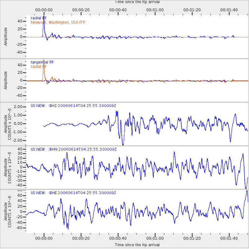
Earthquake location: Rat Islands, Aleutian Islands
Earthquake latitude/longitude: 51.8/177.1
Earthquake time(UTC): 2006/06/14 (165) 04:18:42 GMT
Earthquake Depth: 14 km
Earthquake Magnitude: 5.9 MB, 6.4 MS, 6.4 MW, 6.4 MW
Earthquake Catalog/Contributor: WHDF/NEIC
Network: US United States National Seismic Network
Station: NEW Newport, Washington, USA
Lat/Lon: 48.26 N/117.12 W
Elevation: 760 m
Distance: 41.1 deg
Az: 67.865 deg
Baz: 300.487 deg
Ray Param: 0.07396584
Estimated Moho Depth: 38.0 km
Estimated Crust Vp/Vs: 1.91
Assumed Crust Vp: 6.571 km/s
Estimated Crust Vs: 3.431 km/s
Estimated Crust Poisson's Ratio: 0.31
Radial Match: 92.19156 %
Radial Bump: 273
Transverse Match: 48.62822 %
Transverse Bump: 400
SOD ConfigId: 5745
Insert Time: 2010-03-05 01:45:33.078 +0000
GWidth: 2.5
Max Bumps: 400
Tol: 0.001

Signal To Noise

ChannelStoNSTALTA
US:NEW: :BHN:20060614T04:25:55.300009Z1.71108347.3993E-64.3243363E-6
US:NEW: :BHE:20060614T04:25:55.300009Z3.29701231.6613783E-55.039042E-6
US:NEW: :BHZ:20060614T04:25:55.300009Z3.5866734.1769712E-71.164581E-7
Arrivals
Ps5.7 SECOND
PpPs16 SECOND
PsPs/PpSs21 SECOND