You are here: Home > Network List > US - United States National Seismic Network Stations List
> Station NEW Newport, Washington, USA > Earthquake Result Viewer
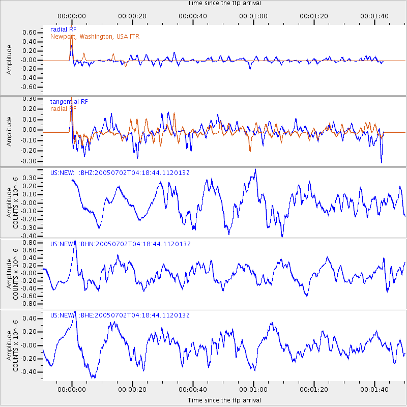
NEW Newport, Washington, USA - Earthquake Result Viewer
*The percent match for this event was below the threshold and hence no stack was calculated.
| Earthquake location: |
Near Coast Of Nicaragua |
| Earthquake latitude/longitude: |
11.4/-86.3 |
| Earthquake time(UTC): |
2005/07/02 (183) 04:11:04 GMT |
| Earthquake Depth: |
40 km |
| Earthquake Magnitude: |
5.4 MB, 5.4 MS, 5.8 MW, 5.0 MD |
| Earthquake Catalog/Contributor: |
WHDF/NEIC |
|
| Network: |
US United States National Seismic Network |
| Station: |
NEW Newport, Washington, USA |
| Lat/Lon: |
48.26 N/117.12 W |
| Elevation: |
760 m |
|
| Distance: |
44.9 deg |
| Az: |
330.933 deg |
| Baz: |
134.529 deg |
| Ray Param: |
$rayparam |
*The percent match for this event was below the threshold and hence was not used in the summary stack. |
|
| Radial Match: |
66.21013 % |
| Radial Bump: |
400 |
| Transverse Match: |
70.49437 % |
| Transverse Bump: |
400 |
| SOD ConfigId: |
3128 |
| Insert Time: |
2010-03-05 01:45:57.728 +0000 |
| GWidth: |
2.5 |
| Max Bumps: |
400 |
| Tol: |
0.001 |
|
Signal To Noise
| Channel | StoN | STA | LTA |
| US:NEW: :BHN:20050702T04:18:44.112013Z | 2.2591746 | 3.9122529E-7 | 1.7317178E-7 |
| US:NEW: :BHE:20050702T04:18:44.112013Z | 2.2513669 | 2.985909E-7 | 1.326265E-7 |
| US:NEW: :BHZ:20050702T04:18:44.112013Z | 1.2453681 | 1.7853964E-7 | 1.4336294E-7 |
| Arrivals |
| Ps | |
| PpPs | |
| PsPs/PpSs | |


