You are here: Home > Network List > TA - USArray Transportable Network (new EarthScope stations) Stations List
> Station J25K Salcha River, AK, USA > Earthquake Result Viewer
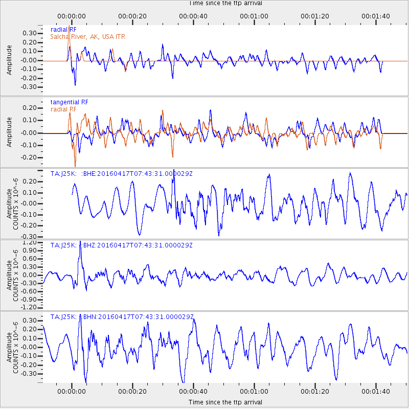
J25K Salcha River, AK, USA - Earthquake Result Viewer
*The percent match for this event was below the threshold and hence no stack was calculated.
| Earthquake location: |
Tonga Islands Region |
| Earthquake latitude/longitude: |
-23.6/-174.3 |
| Earthquake time(UTC): |
2016/04/17 (108) 07:31:03 GMT |
| Earthquake Depth: |
35 km |
| Earthquake Magnitude: |
5.8 MB |
| Earthquake Catalog/Contributor: |
NEIC PDE/NEIC COMCAT |
|
| Network: |
TA USArray Transportable Network (new EarthScope stations) |
| Station: |
J25K Salcha River, AK, USA |
| Lat/Lon: |
64.61 N/145.37 W |
| Elevation: |
949 m |
|
| Distance: |
90.8 deg |
| Az: |
12.047 deg |
| Baz: |
206.369 deg |
| Ray Param: |
$rayparam |
*The percent match for this event was below the threshold and hence was not used in the summary stack. |
|
| Radial Match: |
58.50935 % |
| Radial Bump: |
400 |
| Transverse Match: |
62.922253 % |
| Transverse Bump: |
400 |
| SOD ConfigId: |
7422571 |
| Insert Time: |
2019-04-22 08:37:50.565 +0000 |
| GWidth: |
2.5 |
| Max Bumps: |
400 |
| Tol: |
0.001 |
|
Signal To Noise
| Channel | StoN | STA | LTA |
| TA:J25K: :BHZ:20160417T07:43:31.000029Z | 4.042716 | 4.670648E-7 | 1.1553243E-7 |
| TA:J25K: :BHN:20160417T07:43:31.000029Z | 1.8800809 | 2.1817077E-7 | 1.1604329E-7 |
| TA:J25K: :BHE:20160417T07:43:31.000029Z | 1.2031637 | 1.2890492E-7 | 1.071383E-7 |
| Arrivals |
| Ps | |
| PpPs | |
| PsPs/PpSs | |


