You are here: Home > Network List > TA - USArray Transportable Network (new EarthScope stations) Stations List
> Station O18K Koktuh Hills, AK, USA > Earthquake Result Viewer
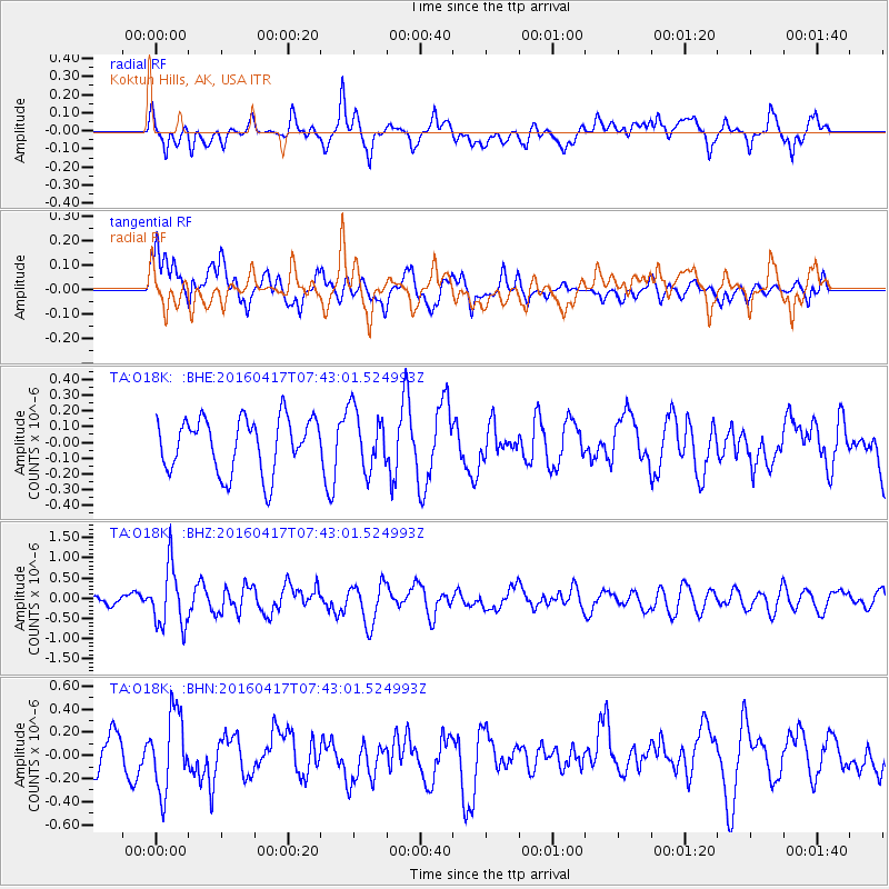
O18K Koktuh Hills, AK, USA - Earthquake Result Viewer
*The percent match for this event was below the threshold and hence no stack was calculated.
| Earthquake location: |
Tonga Islands Region |
| Earthquake latitude/longitude: |
-23.6/-174.3 |
| Earthquake time(UTC): |
2016/04/17 (108) 07:31:03 GMT |
| Earthquake Depth: |
35 km |
| Earthquake Magnitude: |
5.8 MB |
| Earthquake Catalog/Contributor: |
NEIC PDE/NEIC COMCAT |
|
| Network: |
TA USArray Transportable Network (new EarthScope stations) |
| Station: |
O18K Koktuh Hills, AK, USA |
| Lat/Lon: |
59.85 N/155.21 W |
| Elevation: |
544 m |
|
| Distance: |
84.6 deg |
| Az: |
9.557 deg |
| Baz: |
197.564 deg |
| Ray Param: |
$rayparam |
*The percent match for this event was below the threshold and hence was not used in the summary stack. |
|
| Radial Match: |
65.46934 % |
| Radial Bump: |
400 |
| Transverse Match: |
48.674213 % |
| Transverse Bump: |
400 |
| SOD ConfigId: |
7422571 |
| Insert Time: |
2019-04-22 08:38:10.525 +0000 |
| GWidth: |
2.5 |
| Max Bumps: |
400 |
| Tol: |
0.001 |
|
Signal To Noise
| Channel | StoN | STA | LTA |
| TA:O18K: :BHZ:20160417T07:43:01.524993Z | 4.732647 | 7.46609E-7 | 1.5775716E-7 |
| TA:O18K: :BHN:20160417T07:43:01.524993Z | 2.3950572 | 3.3210867E-7 | 1.3866419E-7 |
| TA:O18K: :BHE:20160417T07:43:01.524993Z | 1.0120336 | 1.7413818E-7 | 1.720676E-7 |
| Arrivals |
| Ps | |
| PpPs | |
| PsPs/PpSs | |


