You are here: Home > Network List > UW - Pacific Northwest Regional Seismic Network Stations List
> Station LEBA Lebam, WA, USA > Earthquake Result Viewer
LEBA Lebam, WA, USA - Earthquake Result Viewer
*The percent match for this event was below the threshold and hence no stack was calculated.
| Earthquake location: |
Tonga Islands Region |
| Earthquake latitude/longitude: |
-23.6/-174.3 |
| Earthquake time(UTC): |
2016/04/17 (108) 07:31:03 GMT |
| Earthquake Depth: |
35 km |
| Earthquake Magnitude: |
5.8 MB |
| Earthquake Catalog/Contributor: |
NEIC PDE/NEIC COMCAT |
|
| Network: |
UW Pacific Northwest Regional Seismic Network |
| Station: |
LEBA Lebam, WA, USA |
| Lat/Lon: |
46.55 N/123.56 W |
| Elevation: |
73 m |
|
| Distance: |
83.5 deg |
| Az: |
32.547 deg |
| Baz: |
225.647 deg |
| Ray Param: |
$rayparam |
*The percent match for this event was below the threshold and hence was not used in the summary stack. |
|
| Radial Match: |
47.75382 % |
| Radial Bump: |
400 |
| Transverse Match: |
50.379154 % |
| Transverse Bump: |
400 |
| SOD ConfigId: |
7422571 |
| Insert Time: |
2019-04-22 08:38:55.461 +0000 |
| GWidth: |
2.5 |
| Max Bumps: |
400 |
| Tol: |
0.001 |
|
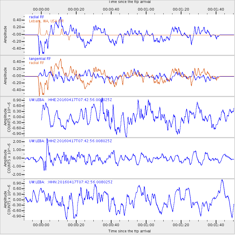
Signal To Noise
| Channel | StoN | STA | LTA |
| UW:LEBA: :HHZ:20160417T07:42:56.008025Z | 7.616231 | 1.0084096E-6 | 1.324027E-7 |
| UW:LEBA: :HHN:20160417T07:42:56.008025Z | 1.9581119 | 4.4487155E-7 | 2.2719414E-7 |
| UW:LEBA: :HHE:20160417T07:42:56.008025Z | 1.5728954 | 5.702789E-7 | 3.6256634E-7 |
| Arrivals |
| Ps | |
| PpPs | |
| PsPs/PpSs | |


