You are here: Home > Network List > UW - Pacific Northwest Regional Seismic Network Stations List
> Station MRBL Marblemount, WA, USA > Earthquake Result Viewer
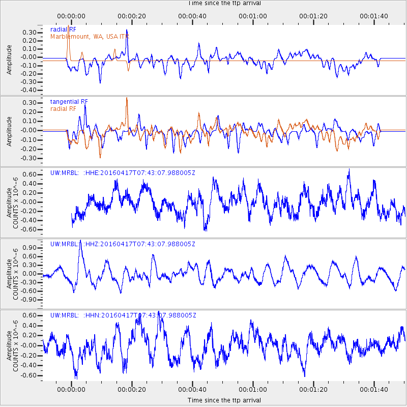
MRBL Marblemount, WA, USA - Earthquake Result Viewer
*The percent match for this event was below the threshold and hence no stack was calculated.
| Earthquake location: |
Tonga Islands Region |
| Earthquake latitude/longitude: |
-23.6/-174.3 |
| Earthquake time(UTC): |
2016/04/17 (108) 07:31:03 GMT |
| Earthquake Depth: |
35 km |
| Earthquake Magnitude: |
5.8 MB |
| Earthquake Catalog/Contributor: |
NEIC PDE/NEIC COMCAT |
|
| Network: |
UW Pacific Northwest Regional Seismic Network |
| Station: |
MRBL Marblemount, WA, USA |
| Lat/Lon: |
48.52 N/121.48 W |
| Elevation: |
75 m |
|
| Distance: |
85.9 deg |
| Az: |
32.088 deg |
| Baz: |
227.134 deg |
| Ray Param: |
$rayparam |
*The percent match for this event was below the threshold and hence was not used in the summary stack. |
|
| Radial Match: |
44.92409 % |
| Radial Bump: |
400 |
| Transverse Match: |
59.985138 % |
| Transverse Bump: |
400 |
| SOD ConfigId: |
7422571 |
| Insert Time: |
2019-04-22 08:38:58.321 +0000 |
| GWidth: |
2.5 |
| Max Bumps: |
400 |
| Tol: |
0.001 |
|
Signal To Noise
| Channel | StoN | STA | LTA |
| UW:MRBL: :HHZ:20160417T07:43:07.988005Z | 5.151553 | 5.4277683E-7 | 1.0536178E-7 |
| UW:MRBL: :HHN:20160417T07:43:07.988005Z | 1.3834008 | 3.237805E-7 | 2.340468E-7 |
| UW:MRBL: :HHE:20160417T07:43:07.988005Z | 0.90379184 | 1.864879E-7 | 2.0633942E-7 |
| Arrivals |
| Ps | |
| PpPs | |
| PsPs/PpSs | |


