You are here: Home > Network List > UW - Pacific Northwest Regional Seismic Network Stations List
> Station YACT Amboy, WA, USA > Earthquake Result Viewer
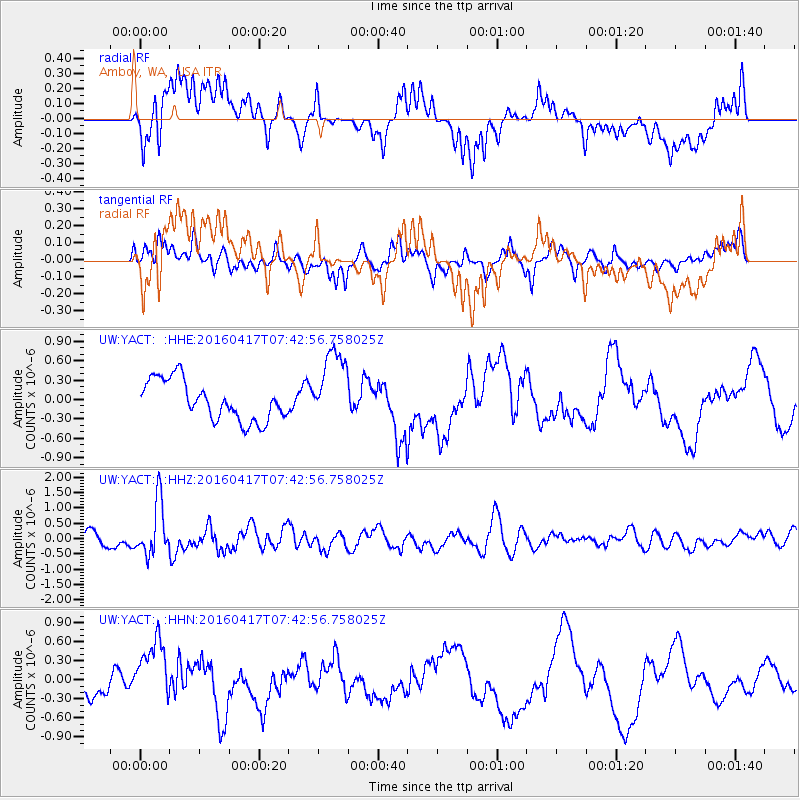
YACT Amboy, WA, USA - Earthquake Result Viewer
*The percent match for this event was below the threshold and hence no stack was calculated.
| Earthquake location: |
Tonga Islands Region |
| Earthquake latitude/longitude: |
-23.6/-174.3 |
| Earthquake time(UTC): |
2016/04/17 (108) 07:31:03 GMT |
| Earthquake Depth: |
35 km |
| Earthquake Magnitude: |
5.8 MB |
| Earthquake Catalog/Contributor: |
NEIC PDE/NEIC COMCAT |
|
| Network: |
UW Pacific Northwest Regional Seismic Network |
| Station: |
YACT Amboy, WA, USA |
| Lat/Lon: |
45.93 N/122.42 W |
| Elevation: |
211 m |
|
| Distance: |
83.7 deg |
| Az: |
33.546 deg |
| Baz: |
226.581 deg |
| Ray Param: |
$rayparam |
*The percent match for this event was below the threshold and hence was not used in the summary stack. |
|
| Radial Match: |
54.30568 % |
| Radial Bump: |
400 |
| Transverse Match: |
60.639126 % |
| Transverse Bump: |
400 |
| SOD ConfigId: |
7422571 |
| Insert Time: |
2019-04-22 08:39:05.408 +0000 |
| GWidth: |
2.5 |
| Max Bumps: |
400 |
| Tol: |
0.001 |
|
Signal To Noise
| Channel | StoN | STA | LTA |
| UW:YACT: :HHZ:20160417T07:42:56.758025Z | 4.055377 | 8.66536E-7 | 2.1367582E-7 |
| UW:YACT: :HHN:20160417T07:42:56.758025Z | 1.7106051 | 5.0970056E-7 | 2.9796507E-7 |
| UW:YACT: :HHE:20160417T07:42:56.758025Z | 1.963862 | 5.9699363E-7 | 3.039896E-7 |
| Arrivals |
| Ps | |
| PpPs | |
| PsPs/PpSs | |


