You are here: Home > Network List > TA - USArray Transportable Network (new EarthScope stations) Stations List
> Station 121A Cookes Peak, Deming, NM, USA > Earthquake Result Viewer
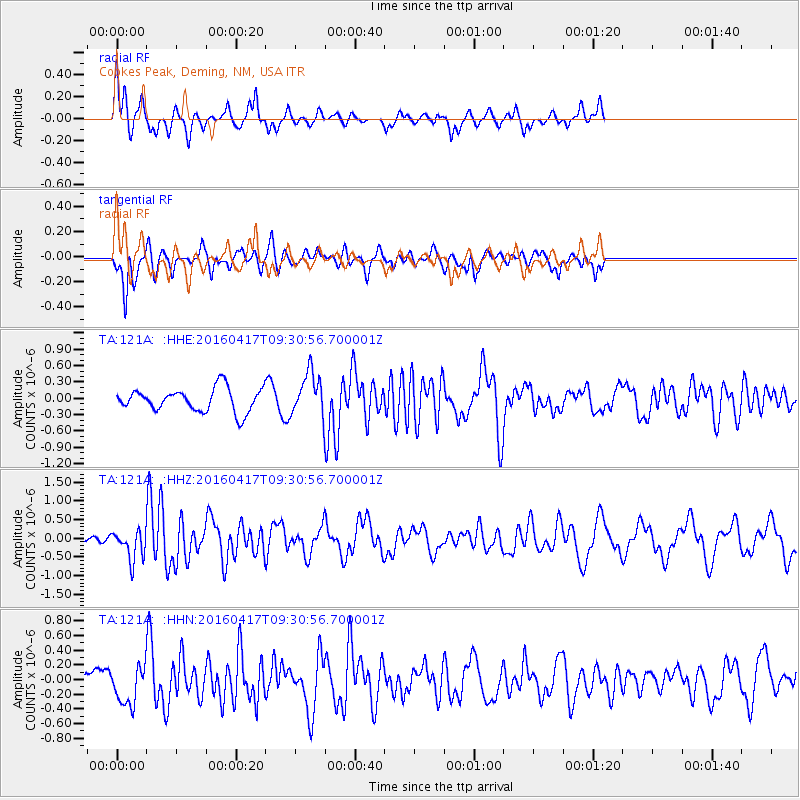
121A Cookes Peak, Deming, NM, USA - Earthquake Result Viewer
*The percent match for this event was below the threshold and hence no stack was calculated.
| Earthquake location: |
Near Coast Of Ecuador |
| Earthquake latitude/longitude: |
-0.3/-80.7 |
| Earthquake time(UTC): |
2016/04/17 (108) 09:23:40 GMT |
| Earthquake Depth: |
10 km |
| Earthquake Magnitude: |
5.5 MB |
| Earthquake Catalog/Contributor: |
NEIC PDE/NEIC COMCAT |
|
| Network: |
TA USArray Transportable Network (new EarthScope stations) |
| Station: |
121A Cookes Peak, Deming, NM, USA |
| Lat/Lon: |
32.53 N/107.79 W |
| Elevation: |
1652 m |
|
| Distance: |
41.4 deg |
| Az: |
324.479 deg |
| Baz: |
136.544 deg |
| Ray Param: |
$rayparam |
*The percent match for this event was below the threshold and hence was not used in the summary stack. |
|
| Radial Match: |
70.71318 % |
| Radial Bump: |
315 |
| Transverse Match: |
79.96163 % |
| Transverse Bump: |
341 |
| SOD ConfigId: |
7422571 |
| Insert Time: |
2019-04-22 08:48:24.457 +0000 |
| GWidth: |
2.5 |
| Max Bumps: |
400 |
| Tol: |
0.001 |
|
Signal To Noise
| Channel | StoN | STA | LTA |
| TA:121A: :HHZ:20160417T09:30:56.700001Z | 2.8042886 | 3.909071E-7 | 1.3939618E-7 |
| TA:121A: :HHN:20160417T09:30:56.700001Z | 1.7633421 | 2.5852196E-7 | 1.4660908E-7 |
| TA:121A: :HHE:20160417T09:30:56.700001Z | 1.8389452 | 3.8894882E-7 | 2.1150647E-7 |
| Arrivals |
| Ps | |
| PpPs | |
| PsPs/PpSs | |


