You are here: Home > Network List > US - United States National Seismic Network Stations List
> Station NEW Newport, Washington, USA > Earthquake Result Viewer
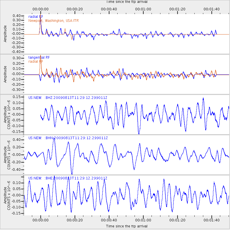
NEW Newport, Washington, USA - Earthquake Result Viewer
*The percent match for this event was below the threshold and hence no stack was calculated.
| Earthquake location: |
Tonga Islands |
| Earthquake latitude/longitude: |
-21.7/-174.6 |
| Earthquake time(UTC): |
2009/08/13 (225) 11:17:01 GMT |
| Earthquake Depth: |
10 km |
| Earthquake Magnitude: |
5.6 MW, 5.3 MB |
| Earthquake Catalog/Contributor: |
WHDF/NEIC |
|
| Network: |
US United States National Seismic Network |
| Station: |
NEW Newport, Washington, USA |
| Lat/Lon: |
48.26 N/117.12 W |
| Elevation: |
760 m |
|
| Distance: |
86.5 deg |
| Az: |
34.352 deg |
| Baz: |
231.771 deg |
| Ray Param: |
$rayparam |
*The percent match for this event was below the threshold and hence was not used in the summary stack. |
|
| Radial Match: |
72.22813 % |
| Radial Bump: |
314 |
| Transverse Match: |
62.603424 % |
| Transverse Bump: |
400 |
| SOD ConfigId: |
2622 |
| Insert Time: |
2010-03-05 01:47:30.719 +0000 |
| GWidth: |
2.5 |
| Max Bumps: |
400 |
| Tol: |
0.001 |
|
Signal To Noise
| Channel | StoN | STA | LTA |
| US:NEW: :BHN:20090813T11:29:12.299011Z | 2.535849 | 1.1763937E-7 | 4.6390525E-8 |
| US:NEW: :BHE:20090813T11:29:12.299011Z | 1.4659092 | 6.545133E-8 | 4.4648964E-8 |
| US:NEW: :BHZ:20090813T11:29:12.299011Z | 1.2378614 | 5.341375E-8 | 4.3150028E-8 |
| Arrivals |
| Ps | |
| PpPs | |
| PsPs/PpSs | |


